MyTopo
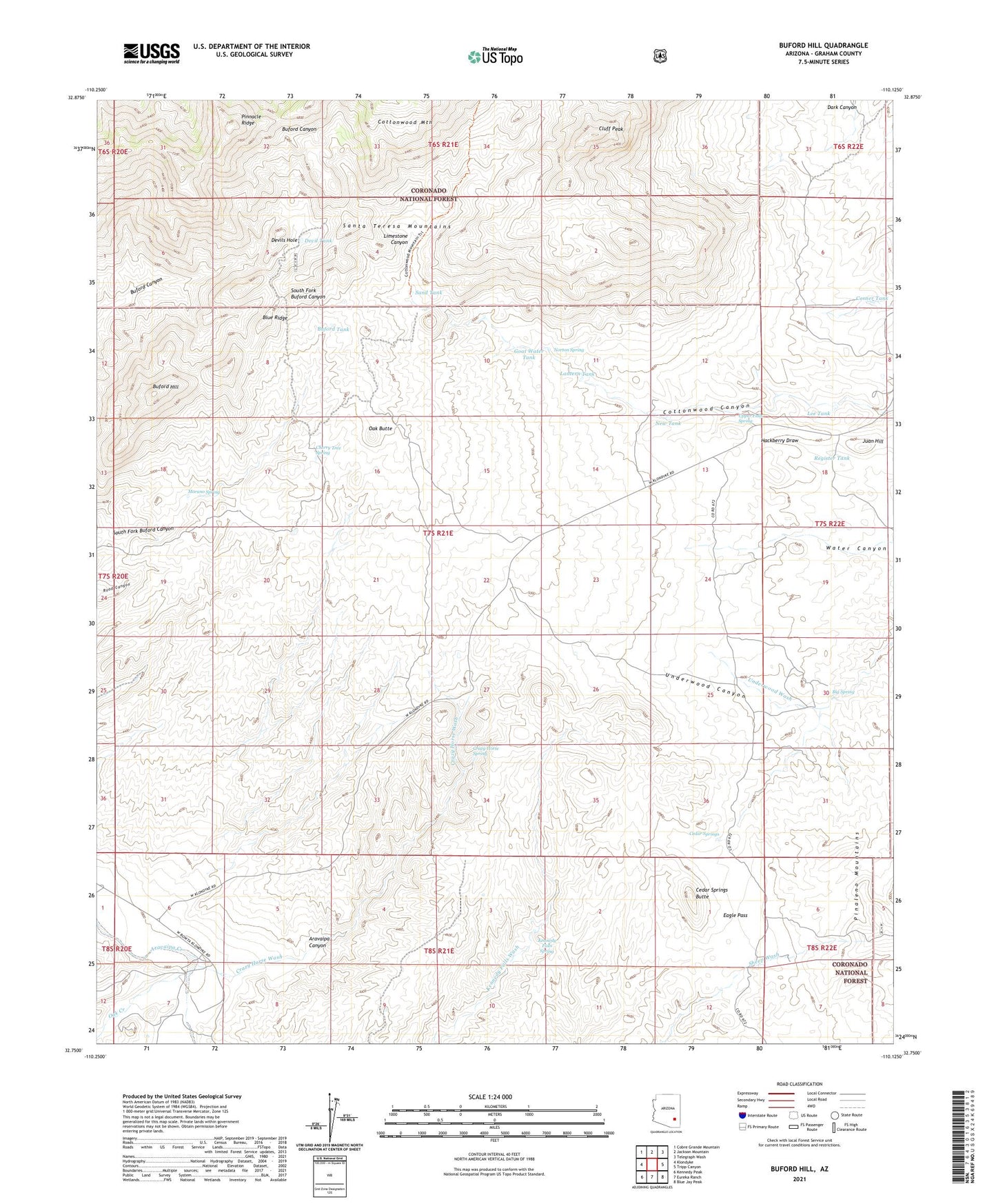
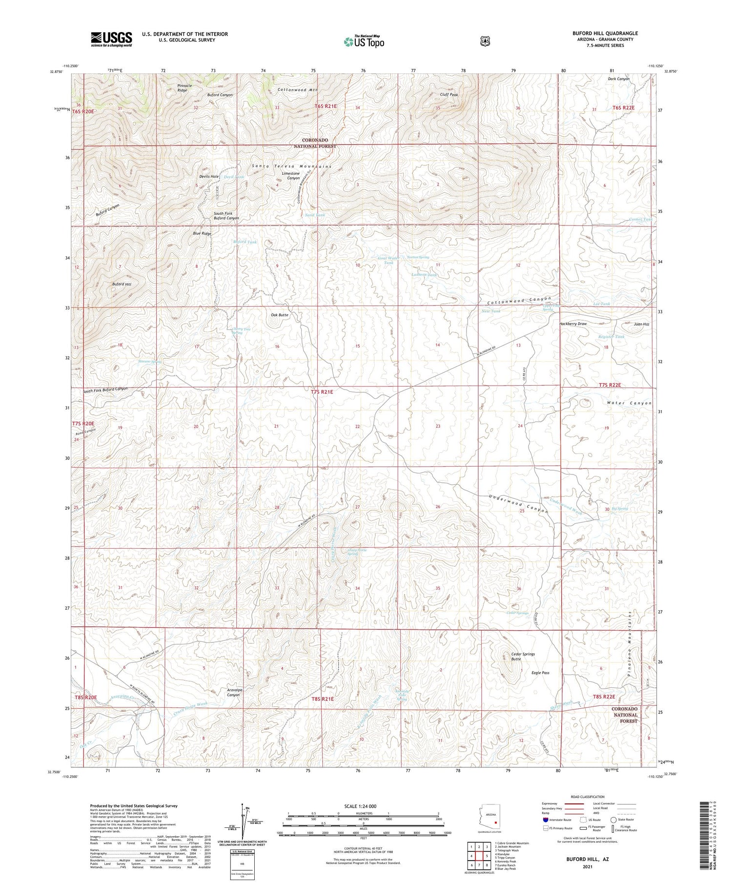
Buford Hill Arizona US Topo Map
Couldn't load pickup availability
Also explore the Buford Hill Forest Service Topo of this same quad for updated USFS data
2021 topographic map quadrangle Buford Hill in the state of Arizona. Scale: 1:24000. Based on the newly updated USGS 7.5' US Topo map series, this map is in the following counties: Graham. The map contains contour data, water features, and other items you are used to seeing on USGS maps, but also has updated roads and other features. This is the next generation of topographic maps. Printed on high-quality waterproof paper with UV fade-resistant inks.
Quads adjacent to this one:
West: Klondyke
Northwest: Cobre Grande Mountain
North: Jackson Mountain
Northeast: Telegraph Wash
East: Tripp Canyon
Southeast: Blue Jay Peak
South: Eureka Ranch
Southwest: Kennedy Peak
This map covers the same area as the classic USGS quad with code o32110g2.
Contains the following named places: Big Spring, Blue Ridge, Buford Hill, Buford Tank, Buhl Ranch, Cedar Springs, Cedar Springs Butte, Cherry Tree Spring, Cluff Peak, Corner Tank, Cottonwood Tank, Crazy Horse Spring, Crazy Horse Wash, Devil Tank, Devils Hole, Eagle Pass, Goat Water Tank, Juan Hill, Kennedy Falls Spring, Lantern Tank, Lee Tank, Limestone Canyon, Morano Spring, New Tank, Norton Spring, Oak Butte, Oak Creek, Pinnacle Ridge, Register Tank, Sand Tank, Upper Falls Spring