MyTopo
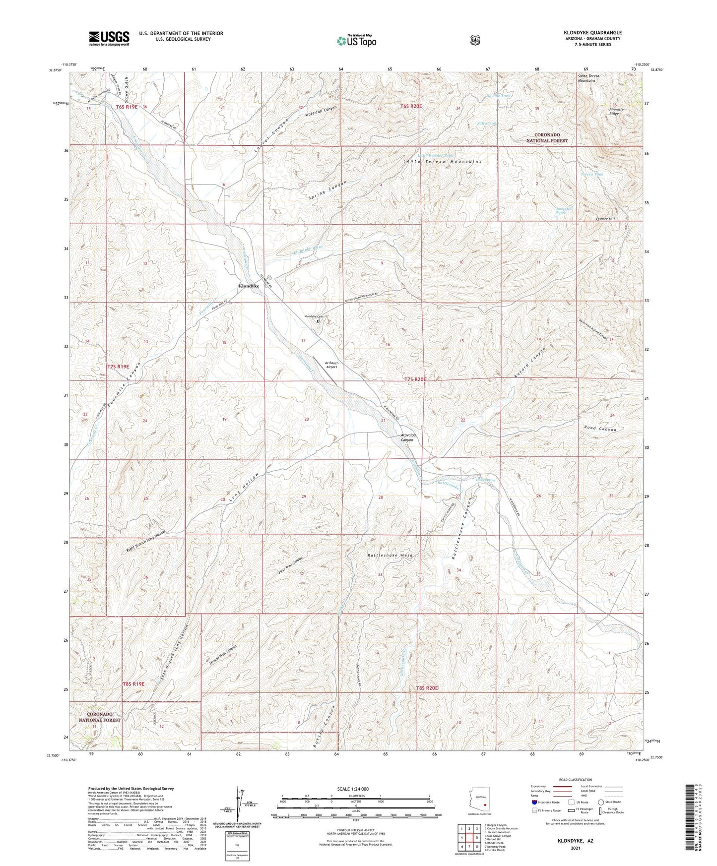
Klondyke Arizona US Topo Map
Couldn't load pickup availability
Also explore the Klondyke Forest Service Topo of this same quad for updated USFS data
2023 topographic map quadrangle Klondyke in the state of Arizona. Scale: 1:24000. Based on the newly updated USGS 7.5' US Topo map series, this map is in the following counties: Graham. The map contains contour data, water features, and other items you are used to seeing on USGS maps, but also has updated roads and other features. This is the next generation of topographic maps. Printed on high-quality waterproof paper with UV fade-resistant inks.
Quads adjacent to this one:
West: Oak Grove Canyon
Northwest: Booger Canyon
North: Cobre Grande Mountain
Northeast: Jackson Mountain
East: Buford Hill
Southeast: Eureka Ranch
South: Kennedy Peak
Southwest: Rhodes Peak
This map covers the same area as the classic USGS quad with code o32110g3.
Contains the following named places: Aravaipa Ranger Station, Av Ranch Airport, Bottle Canyon, Buford Canyon, Crook National Forest, Davidson Ranch, Deep Well, Dog Water Mine, Dowdle Tank, First Trail Canyon, Fourmile Canyon, Fourmile Creek, Haby Spring, Klondyke, Klondyke Cemetery, Klondyke Wash, Lamb Camp, Laurel Canyon, Left Branch Long Hollow, Little Wonder Tank, Long Hollow, Quartz Hill, Quartz Hill Spring, Quinn Mine, Rattlesnake Canyon, Rattlesnake Creek, Right Branch Long Hollow, Road Canyon, Salty Tank, Second Trail Canyon, South Fork Buford Canyon, Spring Canyon, Spring Canyon Tank, Squaw Creek, Squaw Tank, Stowe Gulch, Teresa Tank, Waterfall Canyon