MyTopo
Campbell Francis Wash Arizona US Topo Map
Couldn't load pickup availability
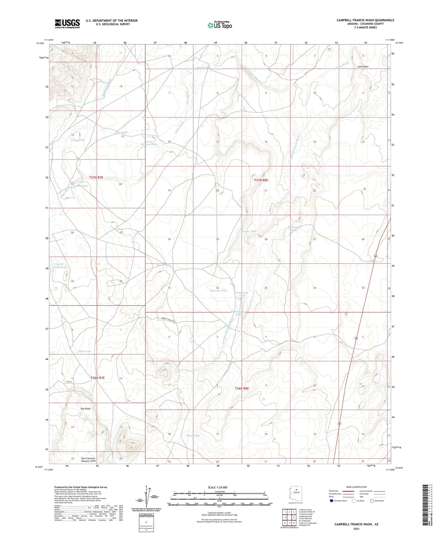
2021 topographic map quadrangle Campbell Francis Wash in the state of Arizona. Scale: 1:24000. Based on the newly updated USGS 7.5' US Topo map series, this map is in the following counties: Coconino. The map contains contour data, water features, and other items you are used to seeing on USGS maps, but also has updated roads and other features. This is the next generation of topographic maps. Printed on high-quality waterproof paper with UV fade-resistant inks.
Quads adjacent to this one:
West: Additional Hill
Northwest: Willows Camp
North: Coconino Point SE
Northeast: Cameron South
East: Gray Mountain
Southeast: Wupatki SW
South: East of S P Mountain
Southwest: S P Mountain
This map covers the same area as the classic USGS quad with code o35111f5.
Contains the following named places: Black Tank, Bull Pasture Tank, Campbell Francis Wash, David Tank, Della Tank, Dougherty Tank, Keetso Tank, Large Whiskers Tank, Lava Point, Lockett Tank, Prosperity Tank, Red Lake Tank, Tanner Tank, The Point, Wauneta Trading Post, Wheelbarrow Tank, Yellow Tank