MyTopo
Caponera Peak Arizona US Topo Map
Couldn't load pickup availability
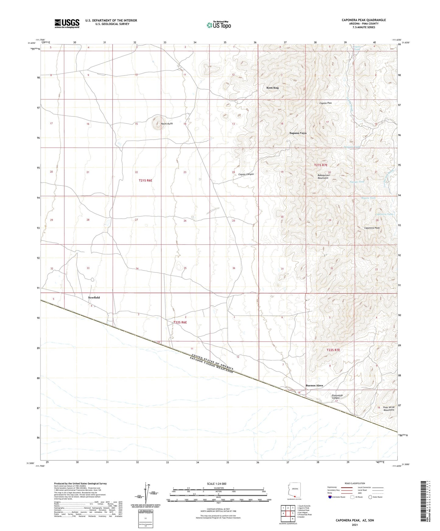
2021 topographic map quadrangle Caponera Peak in the state of Arizona. Scale: 1:24000. Based on the newly updated USGS 7.5' US Topo map series, this map is in the following counties: Pima. The map contains contour data, water features, and other items you are used to seeing on USGS maps, but also has updated roads and other features. This is the next generation of topographic maps. Printed on high-quality waterproof paper with UV fade-resistant inks.
Quads adjacent to this one:
West: San Miguel
Northwest: South Komelik
North: Aguirre Peak
Northeast: Mildred Peak
East: Presumido Peak
Southeast: Sasabe
This map covers the same area as the classic USGS quad with code o31111e6.
Contains the following named places: Antonio Tank, Beyota Tank, Buenos Aires, Caponera Peak, Caponera Tank, Chono Tank, Coyote Canyon, Coyote Pass, Coyote Tank, Hendricks Well, Kom Kug, Kom Kug Windmill, Lopez Well, Nachi Kulik, Newfield, Papago Tank, Presumido Canyon, Saguaro Tank, Sapano Vaya