MyTopo
Mildred Peak Arizona US Topo Map
Couldn't load pickup availability
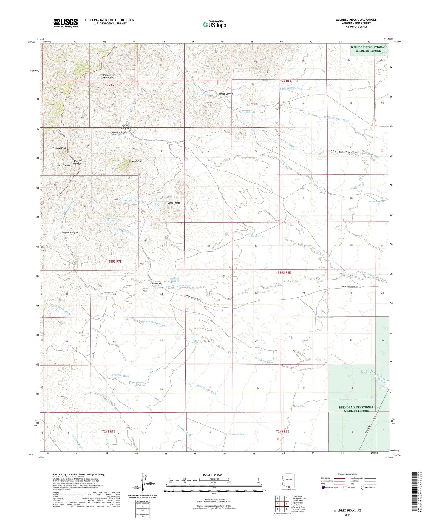
2021 topographic map quadrangle Mildred Peak in the state of Arizona. Scale: 1:24000. Based on the newly updated USGS 7.5' US Topo map series, this map is in the following counties: Pima. The map contains contour data, water features, and other items you are used to seeing on USGS maps, but also has updated roads and other features. This is the next generation of topographic maps. Printed on high-quality waterproof paper with UV fade-resistant inks.
Quads adjacent to this one:
West: Aguirre Peak
Northwest: Chiuli Shaik
North: Baboquivari Peak
Northeast: Fresno Wash
East: Las Guijas
Southeast: Wilbur Canyon
South: Presumido Peak
Southwest: Caponera Peak
This map covers the same area as the classic USGS quad with code o31111f5.
Contains the following named places: Arroyo del Puente, Black Tank, Cemetery Tank, Cerro Prieto, Charlie Bent Well, Chutum Vaya Pass, Clemente Windmill, Corodope Spring, Elgin School, Escondido Spring, Escondido Wash, Fourteen Tank, Gold Bullion Mine, Indian Tank, Jackknife Tank, Jupiter Canyon, Jupiter Mine, Las Moras Ranch, Leyvas Canyon, Middle Tank, Mildred Peak, Milpa Tank, Mitchell Tank, Mormon Tank, Osobavi Peak, Placeritos Wash, Santa Margarita Ranch, Seven X Tank, Shaffer Camp, Shute Tank, Thomas Canyon, Thomas Well, Twin Tanks, Weaver Canyon, West Brown Tank