MyTopo
South Komelik Arizona US Topo Map
Couldn't load pickup availability
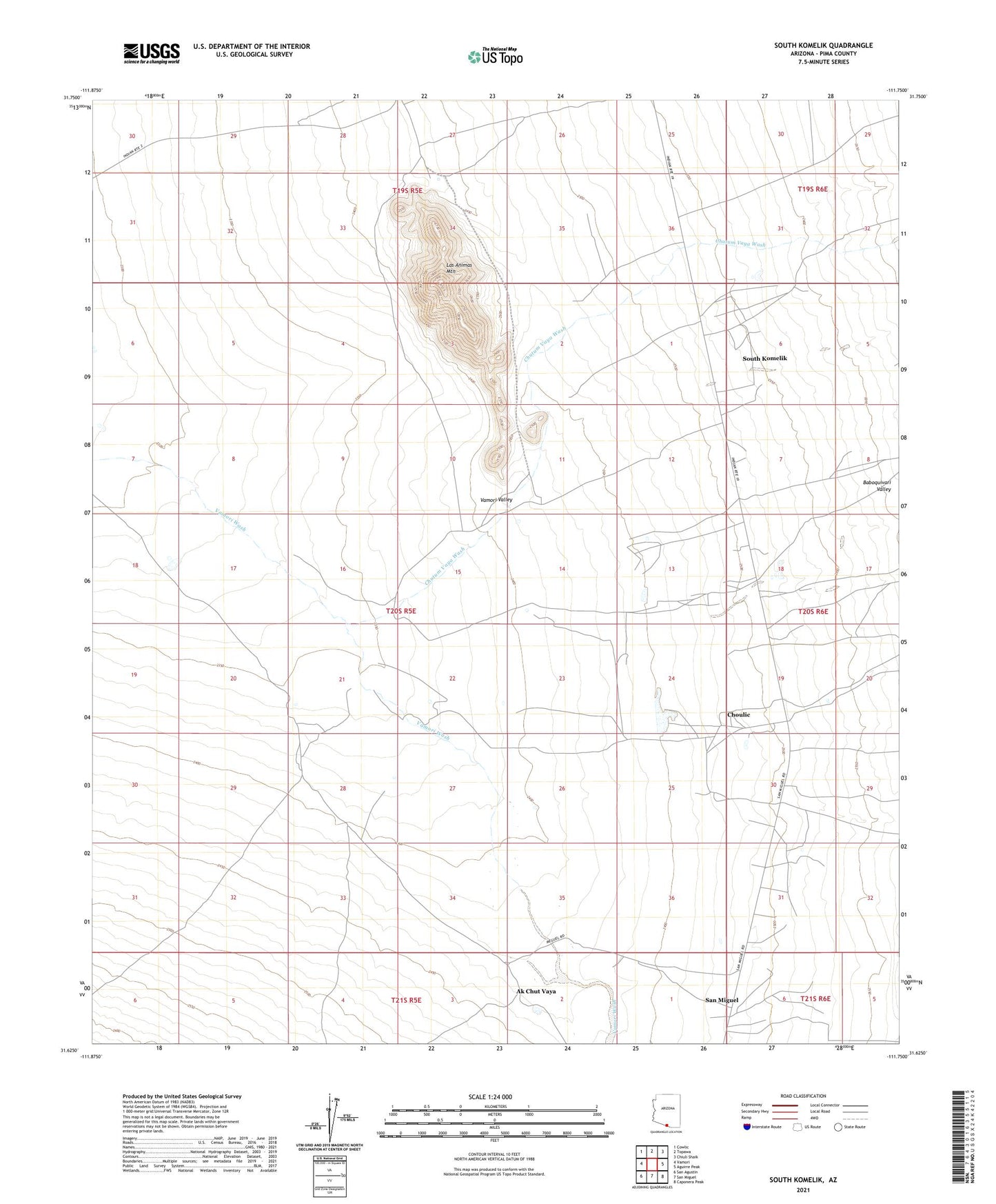
2021 topographic map quadrangle South Komelik in the state of Arizona. Scale: 1:24000. Based on the newly updated USGS 7.5' US Topo map series, this map is in the following counties: Pima. The map contains contour data, water features, and other items you are used to seeing on USGS maps, but also has updated roads and other features. This is the next generation of topographic maps. Printed on high-quality waterproof paper with UV fade-resistant inks.
Quads adjacent to this one:
West: Vamori
Northwest: Cowlic
North: Topawa
Northeast: Chiuli Shaik
East: Aguirre Peak
Southeast: Caponera Peak
South: San Miguel
Southwest: San Agustin
This map covers the same area as the classic USGS quad with code o31111f7.
Contains the following named places: Ak Chut Vaya, Choulic, Chutum Vaya Wash, Horseshoe Well, Las Animas Mountain, San Miguel Census Designated Place, South Komelik, South Komelik Census Designated Place, Supi Oidak