MyTopo
Cedar Basin Arizona US Topo Map
Couldn't load pickup availability
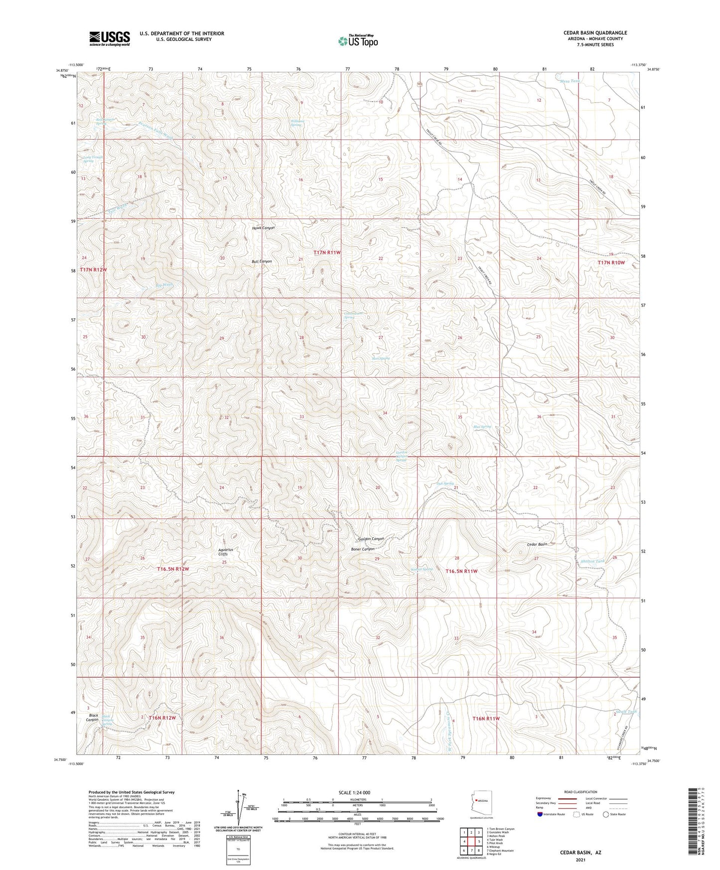
2021 topographic map quadrangle Cedar Basin in the state of Arizona. Scale: 1:24000. Based on the newly updated USGS 7.5' US Topo map series, this map is in the following counties: Mohave. The map contains contour data, water features, and other items you are used to seeing on USGS maps, but also has updated roads and other features. This is the next generation of topographic maps. Printed on high-quality waterproof paper with UV fade-resistant inks.
Quads adjacent to this one:
West: Tule Wash
Northwest: Tom Brown Canyon
North: Gonzales Wash
Northeast: Mohon Peak
East: Pilot Knob
Southeast: Negro Ed
South: Elephant Mountain
Southwest: Wikieup
This map covers the same area as the classic USGS quad with code o34113g4.
Contains the following named places: Antelope Tank, Aquarius Cliffs, Black Canyon, Black Canyon Spring, Blue Spring, Cedar Basin, Cedar Basin Camp, Cottonwood Spring, Gordon Canyon, Gordon Canyon Spring, High-Lonesome Windmill, Long Trough Spring, Mesa Tank, Oak Spring, Red Canyon Spring, Sam Spring, Shelton Tank, Sunburn Windmill, Walnut Spring, Williams Spring, Willow Springs Well