MyTopo
Tom Brown Canyon Arizona US Topo Map
Couldn't load pickup availability
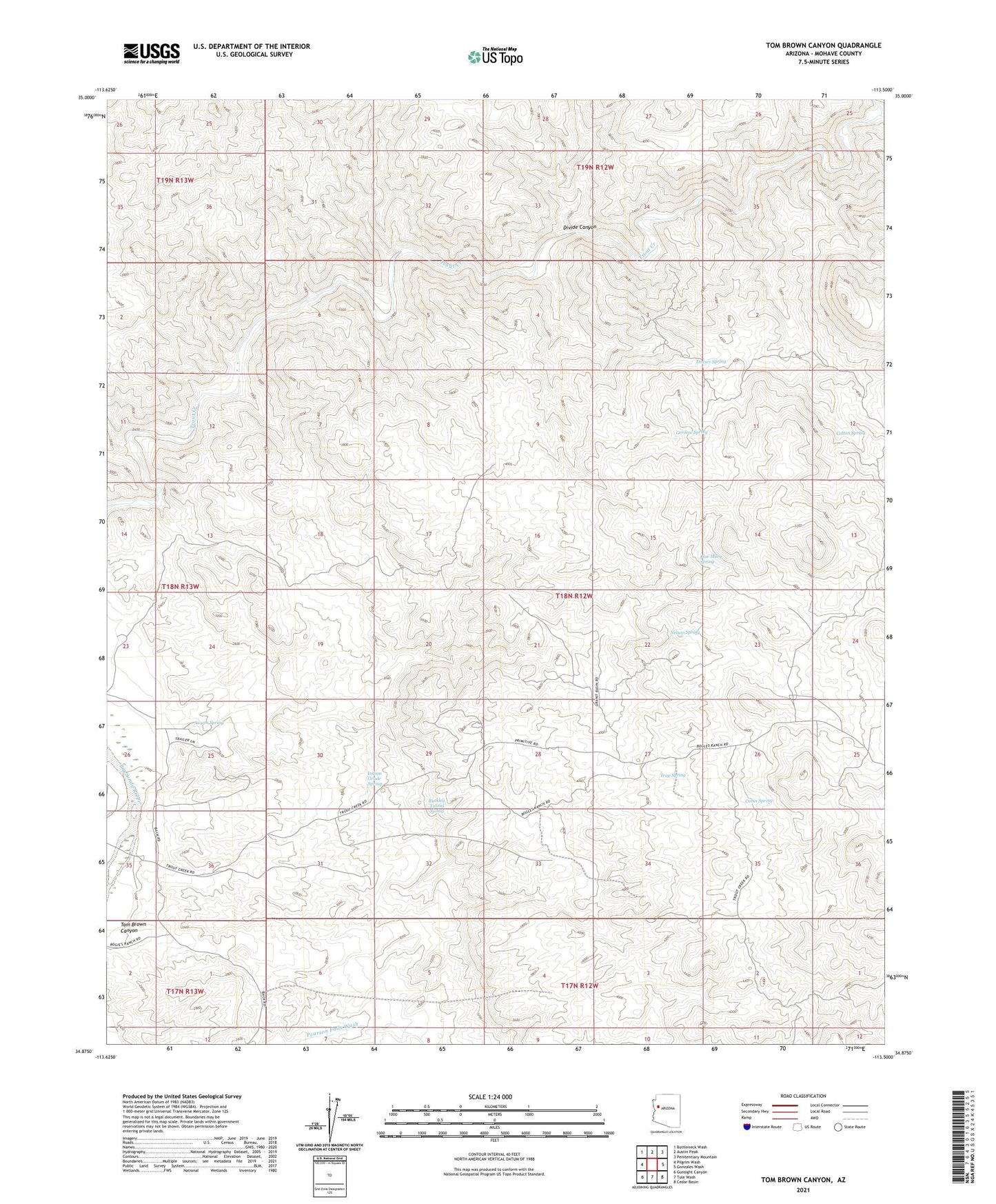
2021 topographic map quadrangle Tom Brown Canyon in the state of Arizona. Scale: 1:24000. Based on the newly updated USGS 7.5' US Topo map series, this map is in the following counties: Mohave. The map contains contour data, water features, and other items you are used to seeing on USGS maps, but also has updated roads and other features. This is the next generation of topographic maps. Printed on high-quality waterproof paper with UV fade-resistant inks.
Quads adjacent to this one:
West: Pilgrim Wash
Northwest: Bottleneck Wash
North: Austin Peak
Northeast: Penitentiary Mountain
East: Gonzales Wash
Southeast: Cedar Basin
South: Tule Wash
Southwest: Gunsight Canyon
This map covers the same area as the classic USGS quad with code o34113h5.
Contains the following named places: Blue Mary Spring, Buckley Tunnel Spring, Cabin Spring, Cane Springs Wash, Cotton Spring, Dinner Spring, Divide Canyon, Gerome Spring, Indian Grade Spring, Lower Parson Well, Lower Tom Brown Well, Nelson Spring, Tom Brown Canyon, Trap Spring, Upper Parson Well, Warm Spring, White Spring Well