MyTopo
Pilot Knob Arizona US Topo Map
Couldn't load pickup availability
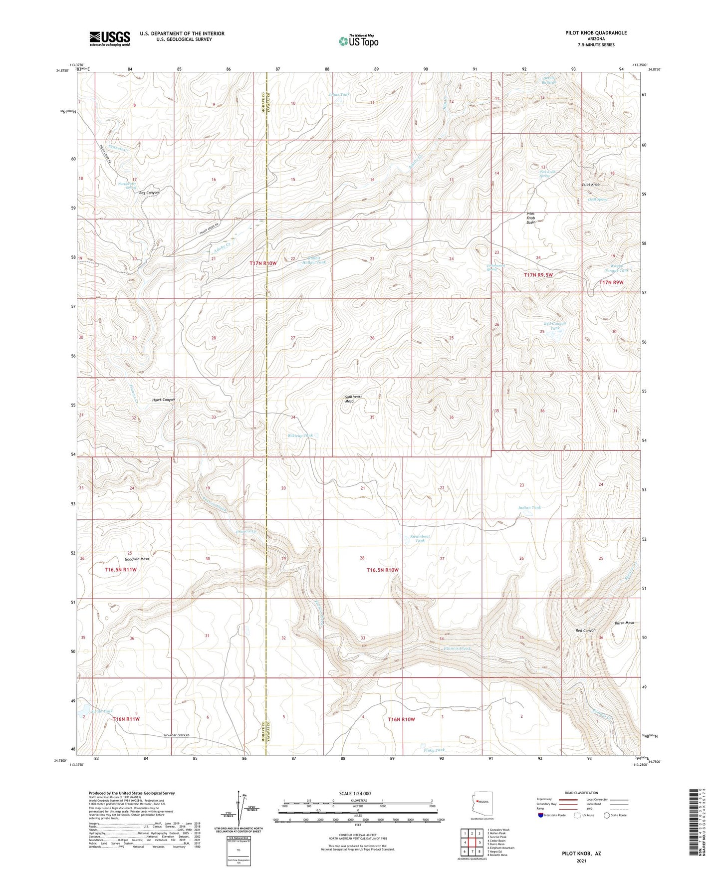
2021 topographic map quadrangle Pilot Knob in the state of Arizona. Scale: 1:24000. Based on the newly updated USGS 7.5' US Topo map series, this map is in the following counties: Yavapai, Mohave. The map contains contour data, water features, and other items you are used to seeing on USGS maps, but also has updated roads and other features. This is the next generation of topographic maps. Printed on high-quality waterproof paper with UV fade-resistant inks.
Quads adjacent to this one:
West: Cedar Basin
Northwest: Gonzales Wash
North: Mohon Peak
Northeast: Sunrise Peak
East: Burro Mesa
Southeast: Bozarth Mesa
South: Negro Ed
Southwest: Elephant Mountain
This map covers the same area as the classic USGS quad with code o34113g3.
Contains the following named places: Adobe Creek, Chalk Spring, Cottonwood Spring, Devils Bathtub, Francis Creek Camp, Goodwin Mesa, Hawk Canyon, Hop Creek, Indian Tank, Johns Tank, Northwater Spring, Old Cofer Headquarters, Pilot Knob, Pilot Knob Basin, Pilot Knob Spring, Pinky Tank, Rabbit Hollow Tank, Rag Canyon, Red Canyon, Red Canyon Tank, Southeast Mesa, Spencer Creek, Steamboat Tank, Swale Tank, Wagon Tongue Tank, Wikieup Tank