MyTopo
Clear Creek Reservoir Arizona US Topo Map
Couldn't load pickup availability
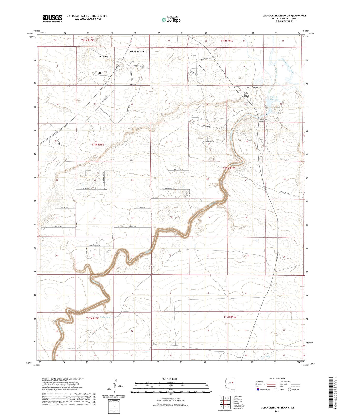
2021 topographic map quadrangle Clear Creek Reservoir in the state of Arizona. Scale: 1:24000. Based on the newly updated USGS 7.5' US Topo map series, this map is in the following counties: Navajo. The map contains contour data, water features, and other items you are used to seeing on USGS maps, but also has updated roads and other features. This is the next generation of topographic maps. Printed on high-quality waterproof paper with UV fade-resistant inks.
Quads adjacent to this one:
West: Rock Station
Northwest: Tucker Mesa
North: Winslow
Northeast: Rincon Ranch
East: Hibbard
Southeast: McCauley Sinks
South: Twentymile Hill
Southwest: Pump Ranch Tank
This map covers the same area as the classic USGS quad with code o34110h6.
Contains the following named places: Arizona State Prison Complex Winslow, Clear Creek, Clear Creek Bridge, Clear Creek Dam Number One, Clear Creek Lake, Clear Creek Number Two Dam, Clear Creek Reservoir, Corbet Tank, Fidel Windmill, Jacks Canyon, Jacks Canyon Bridge, L Tank, McHood Park, Winslow West Census Designated Place