MyTopo
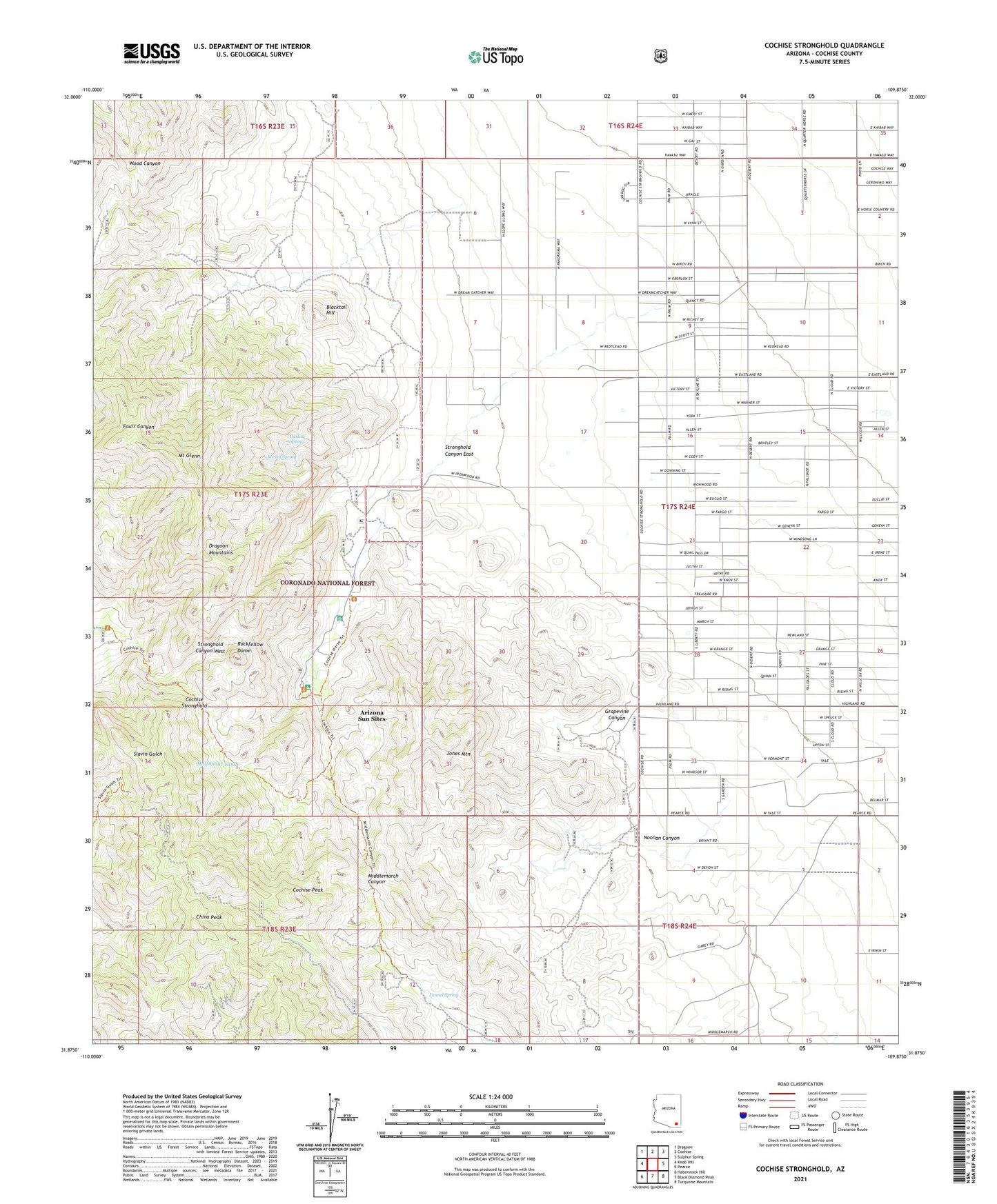
Cochise Stronghold Arizona US Topo Map
Couldn't load pickup availability
Also explore the Cochise Stronghold Forest Service Topo of this same quad for updated USFS data
2021 topographic map quadrangle Cochise Stronghold in the state of Arizona. Scale: 1:24000. Based on the newly updated USGS 7.5' US Topo map series, this map is in the following counties: Cochise. The map contains contour data, water features, and other items you are used to seeing on USGS maps, but also has updated roads and other features. This is the next generation of topographic maps. Printed on high-quality waterproof paper with UV fade-resistant inks.
Quads adjacent to this one:
West: Knob Hill
Northwest: Dragoon
North: Cochise
Northeast: Sulphur Spring
East: Pearce
Southeast: Turquoise Mountain
South: Black Diamond Peak
Southwest: Haberstock Hill
This map covers the same area as the classic USGS quad with code o31109h8.
Contains the following named places: Abril Mine, Arizona Sun Sites, Barret Spring, Blacktail Hill, Carlink Spring, China Peak, Cobra Loma Mine, Cochise Peak, Cochise Stronghold, Cochise Stronghold Campground, Dragoon Mountains, Gordon Camp, Grapevine Canyon, Halfmoon Tank, Johns Well, Jones Mountain, Mount Glenn, Noonan Canyon, Rockfellow Dome, Sorin Camp, Stronghold Canyon East, Tunnel Spring