MyTopo
Dragoon Arizona US Topo Map
Couldn't load pickup availability
Also explore the Dragoon Forest Service Topo of this same quad for updated USFS data
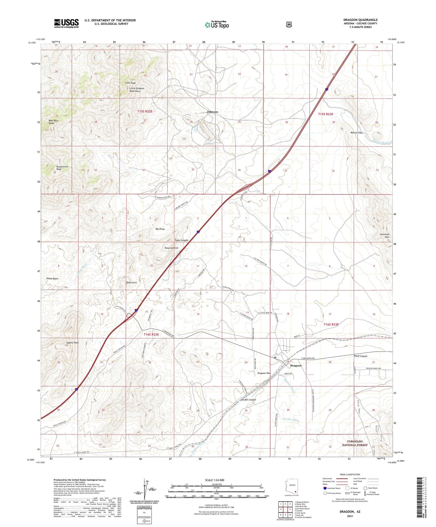
2021 topographic map quadrangle Dragoon in the state of Arizona. Scale: 1:24000. Based on the newly updated USGS 7.5' US Topo map series, this map is in the following counties: Cochise. The map contains contour data, water features, and other items you are used to seeing on USGS maps, but also has updated roads and other features. This is the next generation of topographic maps. Printed on high-quality waterproof paper with UV fade-resistant inks.
Quads adjacent to this one:
West: San Pedro Ranch
Northwest: Deepwell Ranch
North: Steele Hills
Northeast: Red Bird Hills
East: Cochise
Southeast: Cochise Stronghold
South: Knob Hill
Southwest: Saint David
This map covers the same area as the classic USGS quad with code o32110a1.
Contains the following named places: Adams Peak, Adams Ranch, Amerind Foundation Museum, Bluebird Mine, Dragoon, Dragoon Baptist Church, Dragoon Census Designated Place, Dragoon Pass, Dragoon Post Office, Fulton Ranch, Gunnison Hills, Johnson, Johnson Mine, Jordan Canyon, Jordan Wash, Keystone Mine, Lime Peak, Little Dragoon Mountains, Moore Mine, OK Mine, Republic Mine, Russellville, Russellville Peak, Sheep Basin, Texas Arch, Texas Summit, Triangle T Ranch, Walker Ranch, Walnut Gap, Wood Canyon, ZIP Code: 85609