MyTopo
Concho Lake Arizona US Topo Map
Couldn't load pickup availability
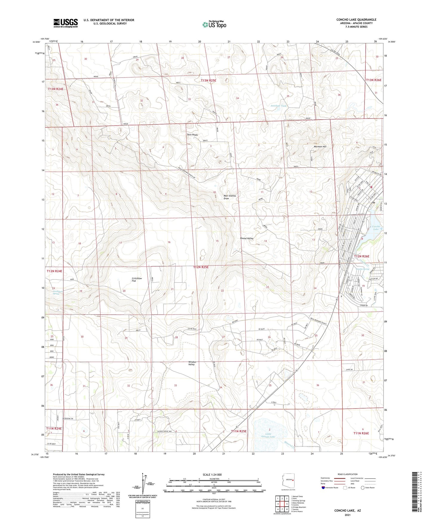
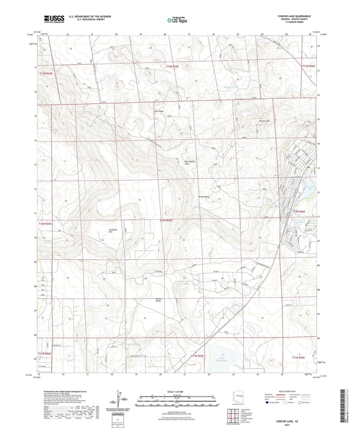
2021 topographic map quadrangle Concho Lake in the state of Arizona. Scale: 1:24000. Based on the newly updated USGS 7.5' US Topo map series, this map is in the following counties: Apache. The map contains contour data, water features, and other items you are used to seeing on USGS maps, but also has updated roads and other features. This is the next generation of topographic maps. Printed on high-quality waterproof paper with UV fade-resistant inks.
Quads adjacent to this one:
West: Mesa Redonda
Northwest: Manuel Seep
North: Hunt
Northeast: Stinking Springs
East: Concho
Southeast: Cerro Hueco
South: Vernon
Southwest: Ortega Mountain
This map covers the same area as the classic USGS quad with code o34109d6.
Contains the following named places: Antelope Tank, Candelaria Spring, Concho Elementary School, Concho Lake, Concho Post Office, Concho Spring, Concho Valley Country Club Golf Course, Concho Volunteer Fire Department, Critchlow Flat, Little Ortega Lake, Mineral Creek, Mormon Hill, Round Valley, Twin Peaks, Windsor Valley