MyTopo
Vernon Arizona US Topo Map
Couldn't load pickup availability
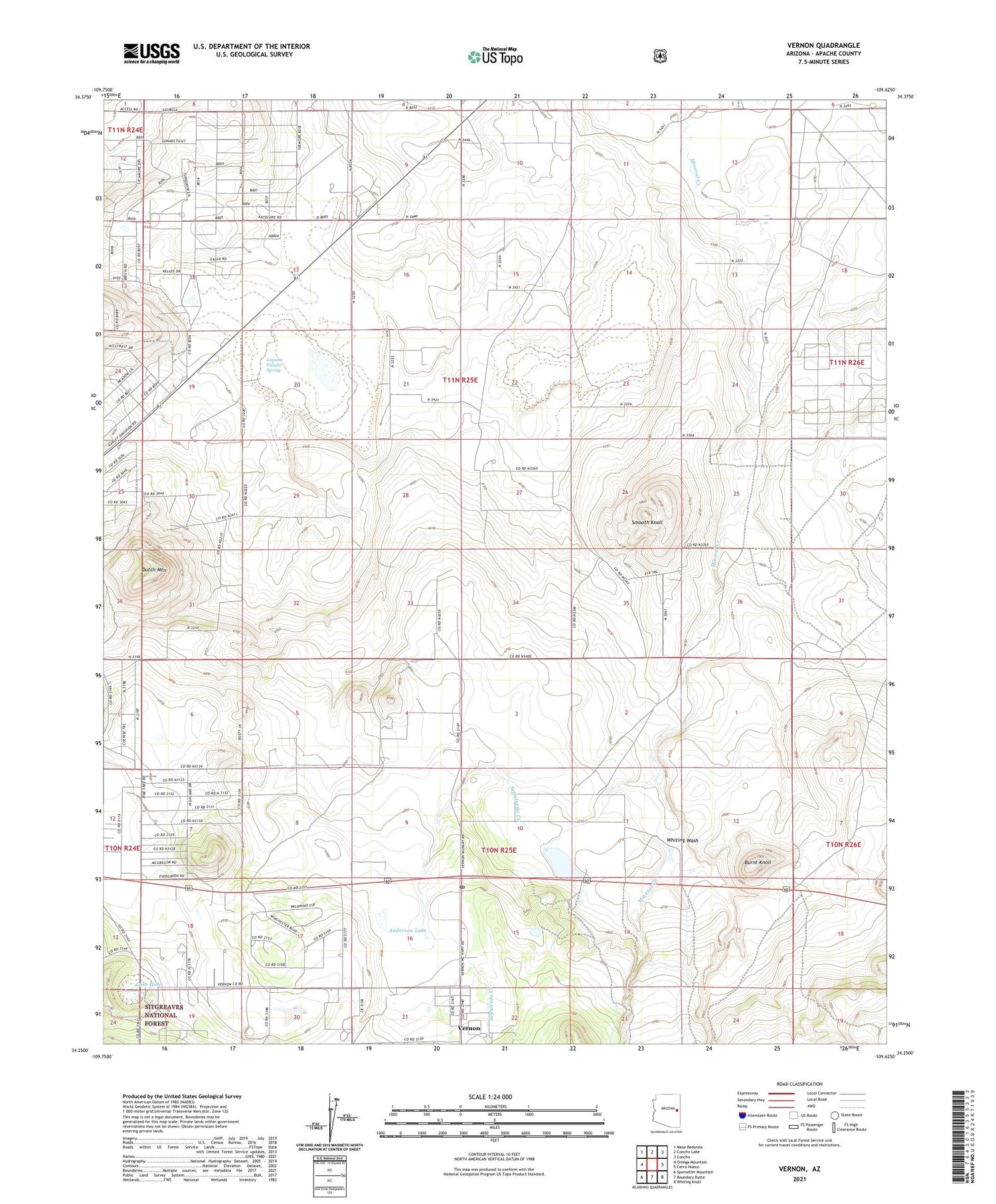
Also explore the Vernon Forest Service Topo of this same quad for updated USFS data
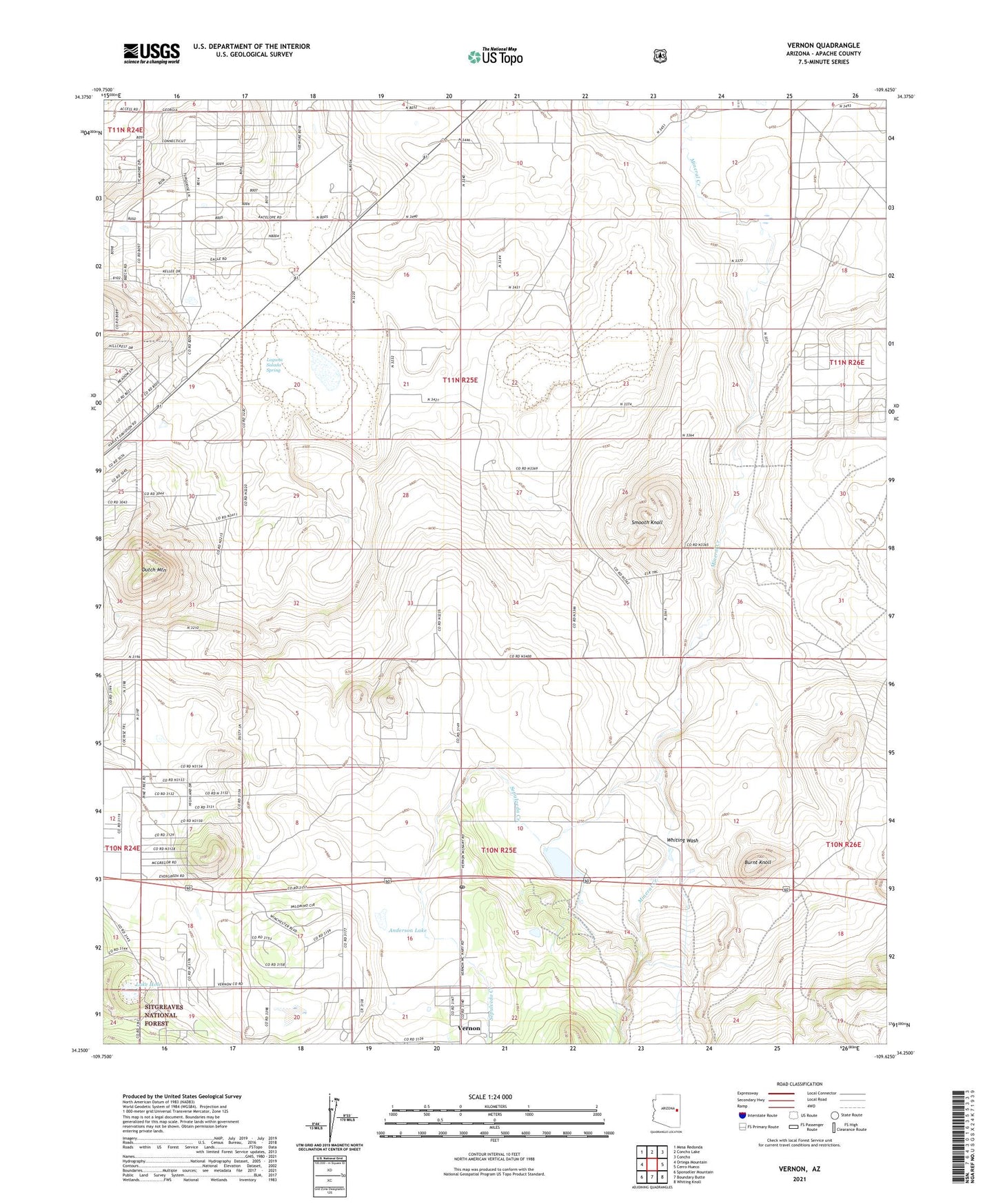
2021 topographic map quadrangle Vernon in the state of Arizona. Scale: 1:24000. Based on the newly updated USGS 7.5' US Topo map series, this map is in the following counties: Apache. The map contains contour data, water features, and other items you are used to seeing on USGS maps, but also has updated roads and other features. This is the next generation of topographic maps. Printed on high-quality waterproof paper with UV fade-resistant inks.
Quads adjacent to this one:
West: Ortega Mountain
Northwest: Mesa Redonda
North: Concho Lake
Northeast: Concho
East: Cerro Hueco
Southeast: Whiting Knoll
South: Boundary Butte
Southwest: Sponseller Mountain
This map covers the same area as the classic USGS quad with code o34109c6.
Contains the following named places: Anderson Lake, Bannon, Burnt Knoll, Dutch Mountain, Floy, Laguna Salada, Laguna Salada Spring, Lake Hole, Sepulveda Creek, Smooth Knoll, Vernon, Vernon Census Designated Place, Vernon Post Office, Vernon Public Library, White Mountain Ultralight Flightpark, Whiting Wash, ZIP Code: 85940