
MyTopo
Cooper Ridge Arizona US Topo Map
Couldn't load pickup availability
Also explore the Cooper Ridge Forest Service Topo of this same quad for updated USFS data
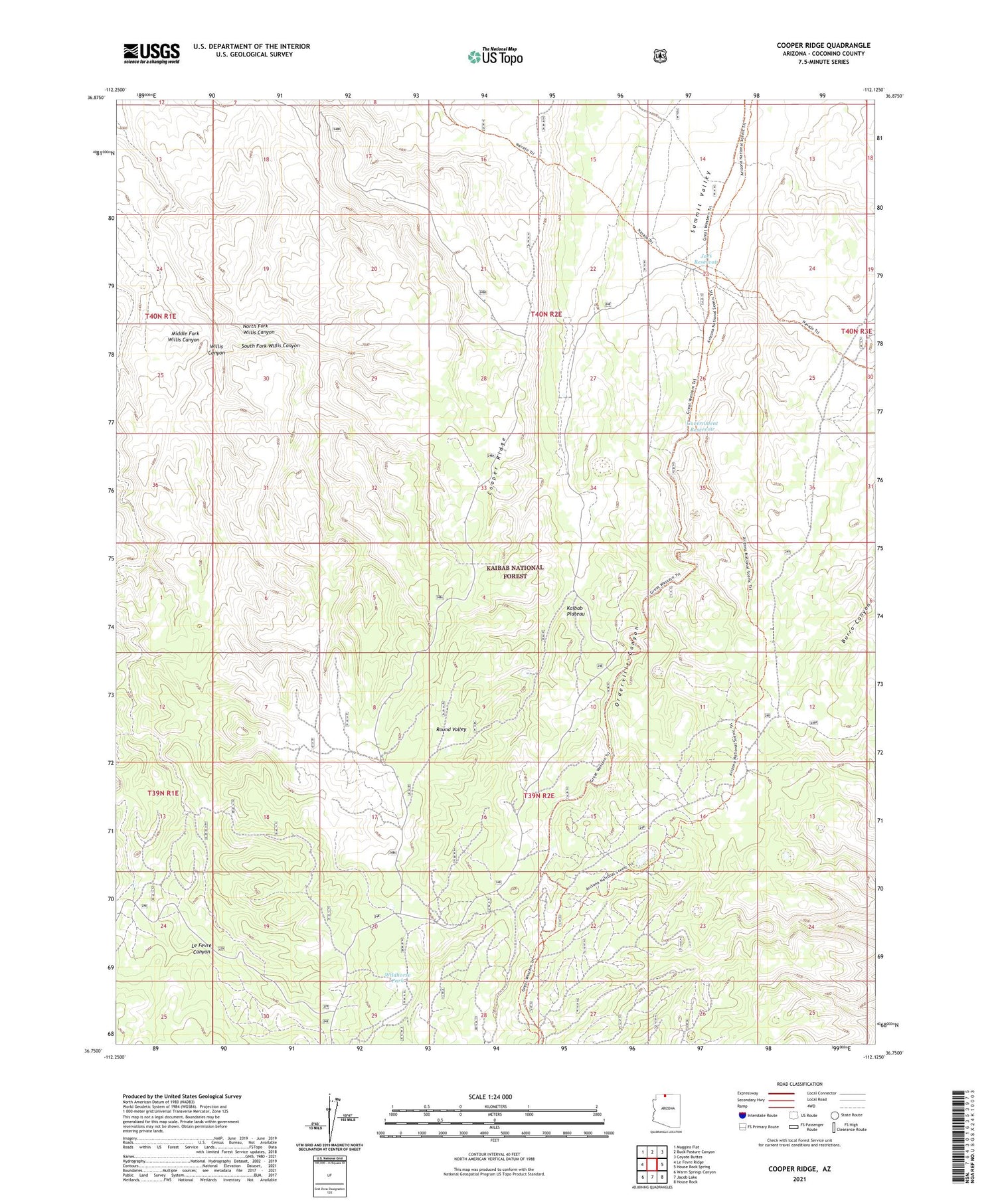
2021 topographic map quadrangle Cooper Ridge in the state of Arizona. Scale: 1:24000. Based on the newly updated USGS 7.5' US Topo map series, this map is in the following counties: Coconino. The map contains contour data, water features, and other items you are used to seeing on USGS maps, but also has updated roads and other features. This is the next generation of topographic maps. Printed on high-quality waterproof paper with UV fade-resistant inks.
Quads adjacent to this one:
West: Le Fevre Ridge
Northwest: Muggins Flat
North: Buck Pasture Canyon
Northeast: Coyote Buttes
East: House Rock Spring
Southeast: House Rock
South: Jacob Lake
Southwest: Warm Springs Canyon
This map covers the same area as the classic USGS quad with code o36112g2.
Contains the following named places: Basin Tank, Burro Apron, Cooper Ridge Tank, Cooper Trick Tank, Government Reservoir, Joes Reservoir, Le Fevre Tank, Lobo Tank, Middle Fork Willis Canyon, North Fork Willis Canyon, Orderville Canyon, Orderville Tank, Orderville Trick Tank, Ponderosa Trick Tank, Round Valley, Round Valley Tank, South Fork Willis Canyon, Stipa Tank, Summit Tank, Summit Trick Tank, Wet Weather Seep, Wildhorse Park


