MyTopo
Crossman Peak Arizona US Topo Map
Couldn't load pickup availability
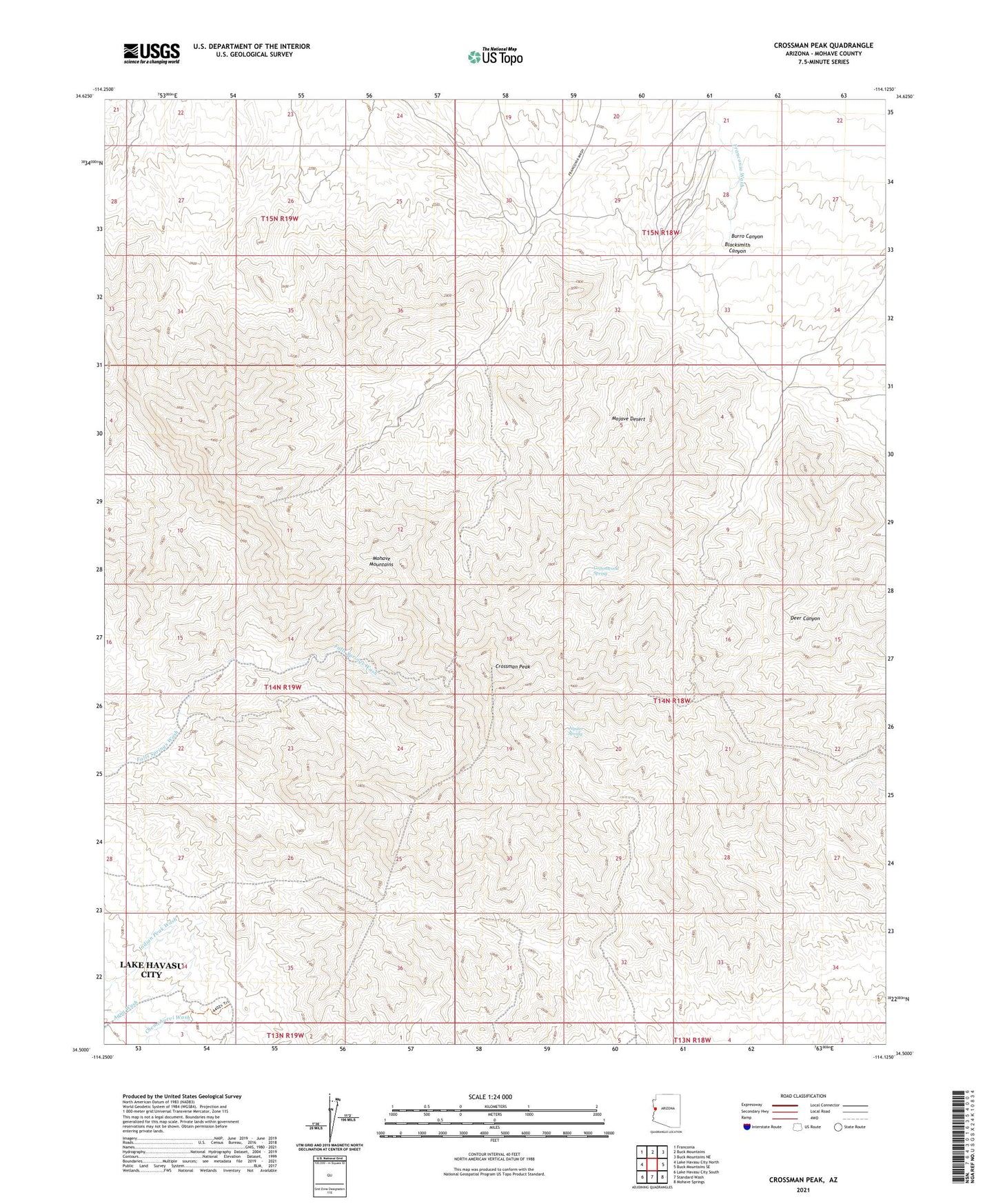
2021 topographic map quadrangle Crossman Peak in the state of Arizona. Scale: 1:24000. Based on the newly updated USGS 7.5' US Topo map series, this map is in the following counties: Mohave. The map contains contour data, water features, and other items you are used to seeing on USGS maps, but also has updated roads and other features. This is the next generation of topographic maps. Printed on high-quality waterproof paper with UV fade-resistant inks.
Quads adjacent to this one:
West: Lake Havasu City North
Northwest: Franconia
North: Buck Mountains
Northeast: Buck Mountains NE
East: Buck Mountains SE
Southeast: Mohave Springs
South: Standard Wash
Southwest: Lake Havasu City South
This map covers the same area as the classic USGS quad with code o34114e2.
Contains the following named places: Arrastra Well, Blacksmith Canyon, Blacksmith Canyon Well, Burro and Cottonwood Well, Burro Canyon, Burro Well, Cottonwood Spring, Crossman Peak, Jupiter Mine, Jupiter Spring, KZUL-FM (Lake Havasu City), Pittsburg Mine, Scotts Well, Sunrise Mine