MyTopo
Standard Wash Arizona US Topo Map
Couldn't load pickup availability
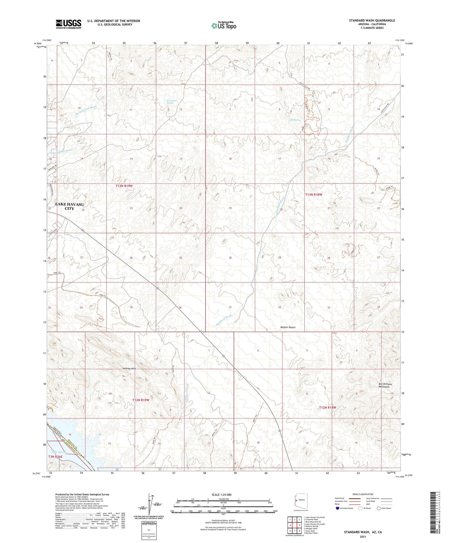
2021 topographic map quadrangle Standard Wash in the state of Arizona. Scale: 1:24000. Based on the newly updated USGS 7.5' US Topo map series, this map is in the following counties: Mohave, San Bernardino. The map contains contour data, water features, and other items you are used to seeing on USGS maps, but also has updated roads and other features. This is the next generation of topographic maps. Printed on high-quality waterproof paper with UV fade-resistant inks.
Quads adjacent to this one:
West: Lake Havasu City South
Northwest: Lake Havasu City North
North: Crossman Peak
Northeast: Buck Mountains SE
East: Mohave Springs
Southeast: Monkeys Head
South: Gene Wash
Southwest: Whipple Wash
Contains the following named places: El Campo Mine, Gold Spring, KNLB-FM (Lake Havasu City), KZUL-FM (Lake Havasu City), Manitowoc Mine, Screwbean Spring