MyTopo
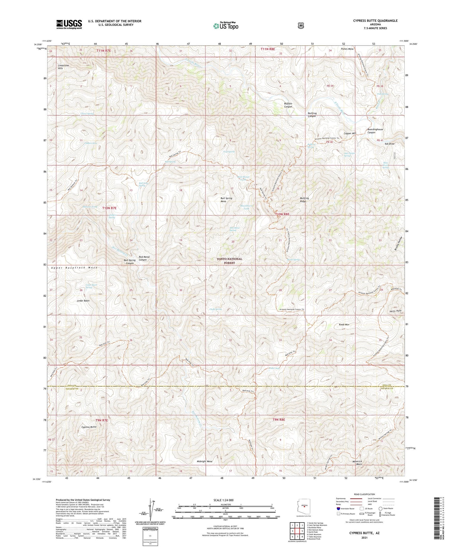
Cypress Butte Arizona US Topo Map
Couldn't load pickup availability
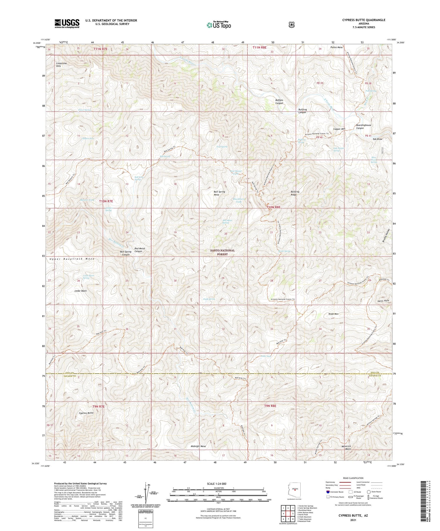
Also explore the Cypress Butte Forest Service Topo of this same quad for updated USFS data
2021 topographic map quadrangle Cypress Butte in the state of Arizona. Scale: 1:24000. Based on the newly updated USGS 7.5' US Topo map series, this map is in the following counties: Gila, Yavapai. The map contains contour data, water features, and other items you are used to seeing on USGS maps, but also has updated roads and other features. This is the next generation of topographic maps. Printed on high-quality waterproof paper with UV fade-resistant inks.
Quads adjacent to this one:
West: Wet Bottom Mesa
Northwest: Verde Hot Springs
North: Cane Springs Mountain
Northeast: Buckhead Mesa
East: North Peak
Southeast: Mazatzal Peak
South: Table Mountain
Southwest: Chalk Mountain
This map covers the same area as the classic USGS quad with code o34111b5.
Contains the following named places: Blackburn Tank, Boardinghouse Canyon, Brush Spring, Buffalo Canyon, Bull Spring, Bull Spring Canyon, Bull Spring Mesa, Bull Trap Spring, Bullfrog Canyon, Bullfrog Ridge, Bullfrog Spring, Cedar Basin, Cedar Basin Spring, Chalk Spring, Childers Seep, Childers Spring, Clover Spring, Copper Mountain, Cottonwood Tank, Cypress Butte, Fuller Seep, Houston Creek, Knob Mountain, L F Ranch, Limestone Hills, Mazatzal Wilderness, Meteor Tank, Midnight Mesa, Mine Road Spring, Oak Thicket Spring, Polk Spring, Red Metal Canyon, Red Metal Spring, Red Metal Tank, Rock Creek, Trail Spring, Tub Draw, Upper Racetrack Mesa