MyTopo
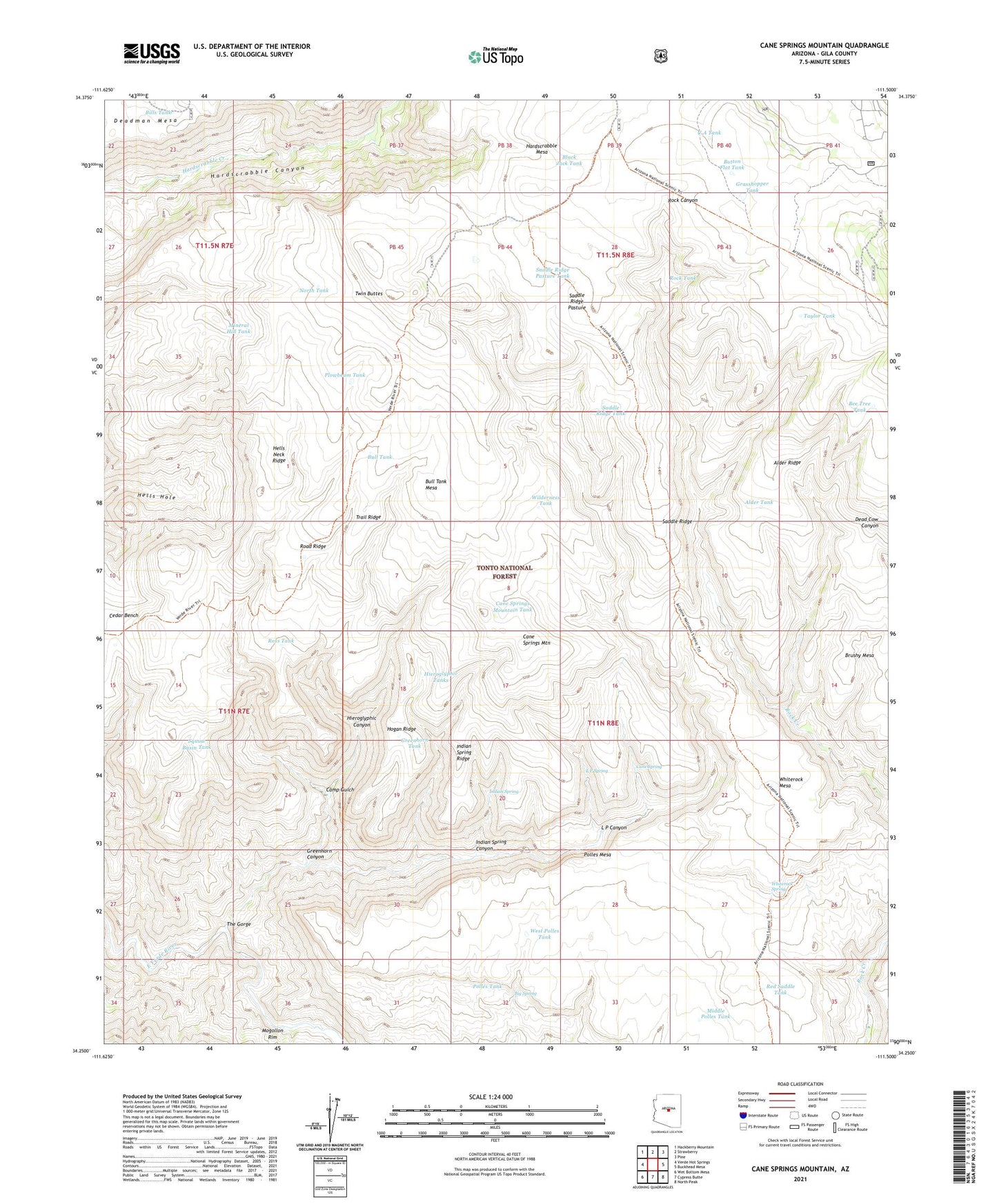
Cane Springs Mountain Arizona US Topo Map
Couldn't load pickup availability
Also explore the Cane Springs Mountain Forest Service Topo of this same quad for updated USFS data
2023 topographic map quadrangle Cane Springs Mountain in the state of Arizona. Scale: 1:24000. Based on the newly updated USGS 7.5' US Topo map series, this map is in the following counties: Gila. The map contains contour data, water features, and other items you are used to seeing on USGS maps, but also has updated roads and other features. This is the next generation of topographic maps. Printed on high-quality waterproof paper with UV fade-resistant inks.
Quads adjacent to this one:
West: Verde Hot Springs
Northwest: Hackberry Mountain
North: Strawberry
Northeast: Pine
East: Buckhead Mesa
Southeast: North Peak
South: Cypress Butte
Southwest: Wet Bottom Mesa
This map covers the same area as the classic USGS quad with code o34111c5.
Contains the following named places: Alder Ridge, Alder Tank, Bee Tree Tank, Big Spring, Bills Tank, Black Jack Tank, Brushy Mesa, Bull Tank, Bull Tank Mesa, Button Flat Tank, Camp Gulch, Cane Spring, Cane Springs Mountain, Cane Springs Mountain Tank, Cedar Bench, Grasshopper Tank, Greenhorn Canyon, Greenhorn Tank, Hardscrabble Mesa, Hells Neck Ridge, Hieroglyphic Canyon, Hieroglyphic Tanks, Hogan Ridge, Indian Spring, Indian Spring Canyon, Indian Spring Ridge, L P Canyon, L P Spring, Middle Polles Tank, Mineral Hill Tank, Mogollon Rim, North Tank, Plowbeam Tank, Polles Mesa, Polles Tank, Red Saddle Tank, Road Ridge, Rock Tank, Ross Tank, Saddle Corral, Saddle Ridge, Saddle Ridge Pasture, Saddle Ridge Pasture Tank, Saddle Ridge Tank, Squaw Basin Tank, Taylor Tank, The Gorge, Trail Ridge, Twin Buttes, U A Tank, West Polles Tank, Whiterock Mesa, Whiterock Spring, Wilderness Tank, ZIP Code: 85544