
MyTopo
Wet Bottom Mesa Arizona US Topo Map
Couldn't load pickup availability
Also explore the Wet Bottom Mesa Forest Service Topo of this same quad for updated USFS data
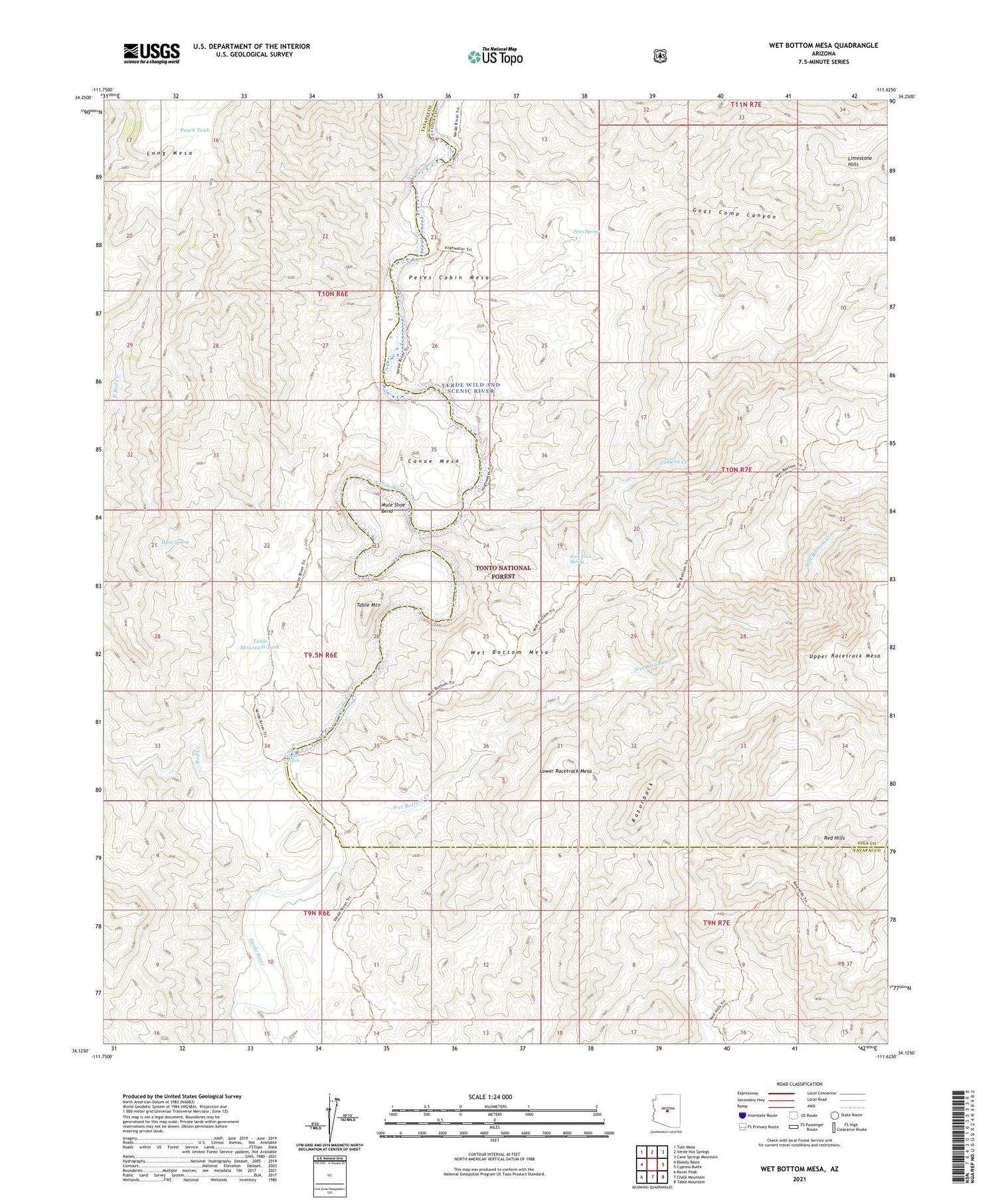
2021 topographic map quadrangle Wet Bottom Mesa in the state of Arizona. Scale: 1:24000. Based on the newly updated USGS 7.5' US Topo map series, this map is in the following counties: Yavapai, Gila. The map contains contour data, water features, and other items you are used to seeing on USGS maps, but also has updated roads and other features. This is the next generation of topographic maps. Printed on high-quality waterproof paper with UV fade-resistant inks.
Quads adjacent to this one:
West: Bloody Basin
Northwest: Tule Mesa
North: Verde Hot Springs
Northeast: Cane Springs Mountain
East: Cypress Butte
Southeast: Table Mountain
South: Chalk Mountain
Southwest: Rover Peak
This map covers the same area as the classic USGS quad with code o34111b6.
Contains the following named places: Canoe Mesa, Canyon Creek, Clover Creek, Cottonwood Creek, Goat Camp Canyon, Goat Camp Creek, Lower Racetrack Mesa, Marie Spring, Mule Shoe Bend, Peach Tank, Petes Cabin Mesa, Petes Spring, Razorback, Red Creek Rapids, Red Hills, Rock Tank Spring, Table Mountain, Table Mountain Tank, Wet Bottom Creek, Wet Bottom Mesa


