MyTopo
Dean Peak Arizona US Topo Map
Couldn't load pickup availability
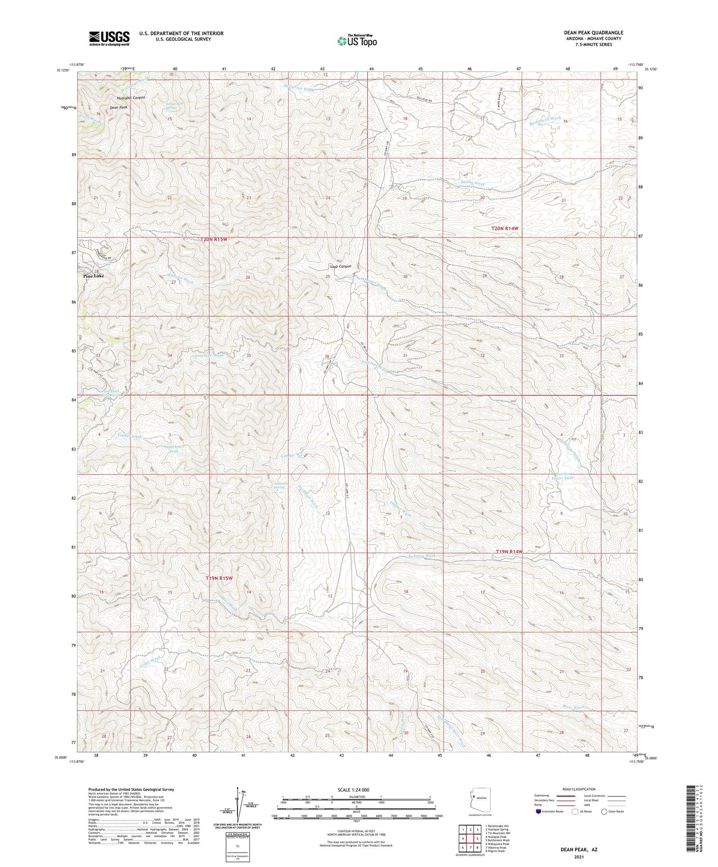
2021 topographic map quadrangle Dean Peak in the state of Arizona. Scale: 1:24000. Based on the newly updated USGS 7.5' US Topo map series, this map is in the following counties: Mohave. The map contains contour data, water features, and other items you are used to seeing on USGS maps, but also has updated roads and other features. This is the next generation of topographic maps. Printed on high-quality waterproof paper with UV fade-resistant inks.
Quads adjacent to this one:
West: Hualapai Peak
Northwest: Rattlesnake Hill
North: Hualapai Spring
Northeast: Tin Mountain NW
East: Bottleneck Wash
Southeast: Pilgrim Wash
South: Hibernia Peak
Southwest: Wabayuma Peak
This map covers the same area as the classic USGS quad with code o35113a7.
Contains the following named places: Berry Tank, Bottleneck Windmill, Dean Peak, Democrat Mine, Gold King Mine, Jackman Spring, Jackman Wash, Merlo Mine, Mica Giant Mine, New Years Cabin Spring, Odle Ranch, Pine Lake, Pine Lake Census Designated Place, Soap Canyon, Standard Mineral Mine, Stokes Well, Sugarbowl Tank, Wheeler Tank, Wild Cow Campground, Wooden Tower Tank, Yellow Pine Spring