MyTopo
Tin Mountain NW Arizona US Topo Map
Couldn't load pickup availability
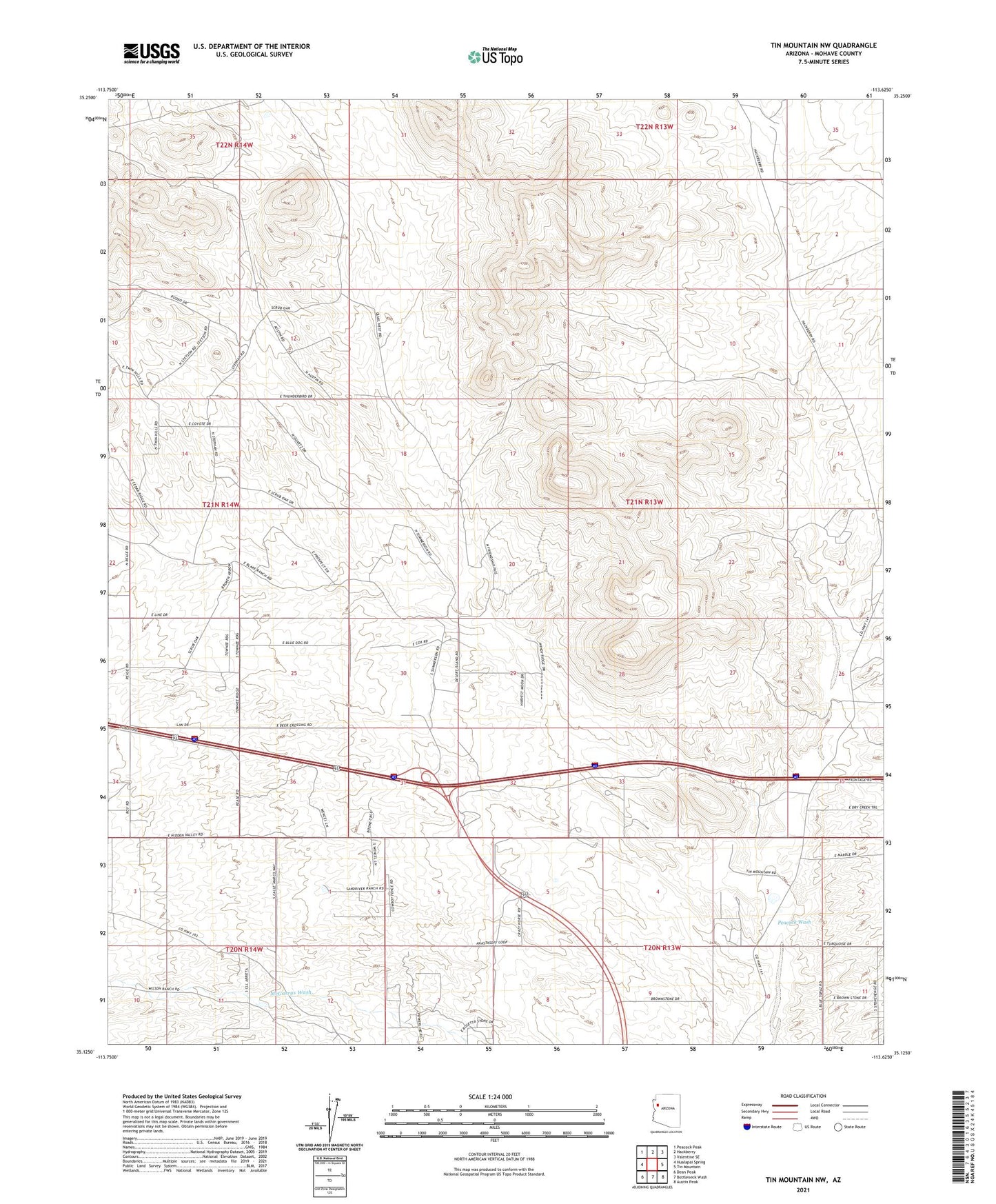
2021 topographic map quadrangle Tin Mountain NW in the state of Arizona. Scale: 1:24000. Based on the newly updated USGS 7.5' US Topo map series, this map is in the following counties: Mohave. The map contains contour data, water features, and other items you are used to seeing on USGS maps, but also has updated roads and other features. This is the next generation of topographic maps. Printed on high-quality waterproof paper with UV fade-resistant inks.
Quads adjacent to this one:
West: Hualapai Spring
Northwest: Peacock Peak
North: Hackberry
Northeast: Valentine SE
East: Tin Mountain
Southeast: Austin Peak
South: Bottleneck Wash
Southwest: Dean Peak
This map covers the same area as the classic USGS quad with code o35113b6.
Contains the following named places: Cofer Dam, Peacock Wash, ZIP Code: 86401