MyTopo
Douglas Arizona US Topo Map
Couldn't load pickup availability
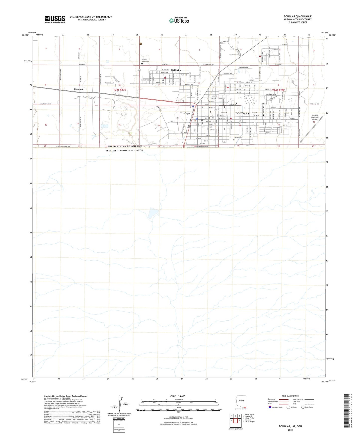
2021 topographic map quadrangle Douglas in the state of Arizona. Scale: 1:24000. Based on the newly updated USGS 7.5' US Topo map series, this map is in the following counties: Cochise. The map contains contour data, water features, and other items you are used to seeing on USGS maps, but also has updated roads and other features. This is the next generation of topographic maps. Printed on high-quality waterproof paper with UV fade-resistant inks.
Quads adjacent to this one:
West: Paul Spur
Northwest: Double Adobe
North: Douglas NE
Northeast: College Peaks
East: East of Douglas
This map covers the same area as the classic USGS quad with code o31109c5.
Contains the following named places: Agua Prieta Substation, Bible Baptist Church, Border Air Museum, Calumet, Calvary Cemetery, Center for Academic Success High School, Church of Christ, City of Douglas, City of Douglas Municipal Golf Course, Clawson Elementary School, Cochise County Sheriff's Office Douglas Patrol District, Copper Queen Smelter, Cypress Inn Assisted Living Center, Douglas, Douglas City Hall, Douglas Early Learning Center, Douglas Fire Department, Douglas High School, Douglas Municipal Airport, Douglas Municipal Pumping Plant, Douglas Police Department, Douglas Post Office, Douglas Public Library, Douglas Substation, Emmanuel Lutheran Church, Fairview Substation, Faith Ministries Church, Faras Elementary School, Fifteenth Street Park, Fifteenth Street School, Fifth Street Park, First Assembly of God, First Baptist Church, First Presbyterian Church, Foothills Christian Church, Geronimo Trail, Grace United Methodist Church, Immaculate Conception Church, Infinia at Douglas, Joe Carlson Elementary School, KAPR-AM (Douglas), KDAP-AM (Douglas), KDAP-FM (Douglas), Kingdom Hall of Jehovahs Witnesses, KKRK-FM (Douglas), Loretto Catholic School, Maryvale School, Mexican Consulate, Mountain View Christian School, Omega Alpha Academy, Paul Huber Middle School, Pirtleville, Pirtleville Census Designated Place, Pirtleville Fire District, Pirtleville Post Office, Port of Entry Douglas, PPEP TEC High School - Raul H Castro Learning Center, Ray Borane Middle School, Sacred Heart Cemetery, Sacred Heart Chapel, Saint Bernard's Church, Saint Paul Evangelical Lutheran Church, Saint Stephen's Episcopal Church, Sarah Marley Elementary School, Southeast Arizona Medical Center, Stevenson Elementary School, Sunnyside Volunteer Fire District, Sunspots South Mobile Home Park, Tenth Street Park, The Church of Jesus Christ of Latter Day Saints, ZIP Code: 85626