
MyTopo
College Peaks Arizona US Topo Map
Couldn't load pickup availability
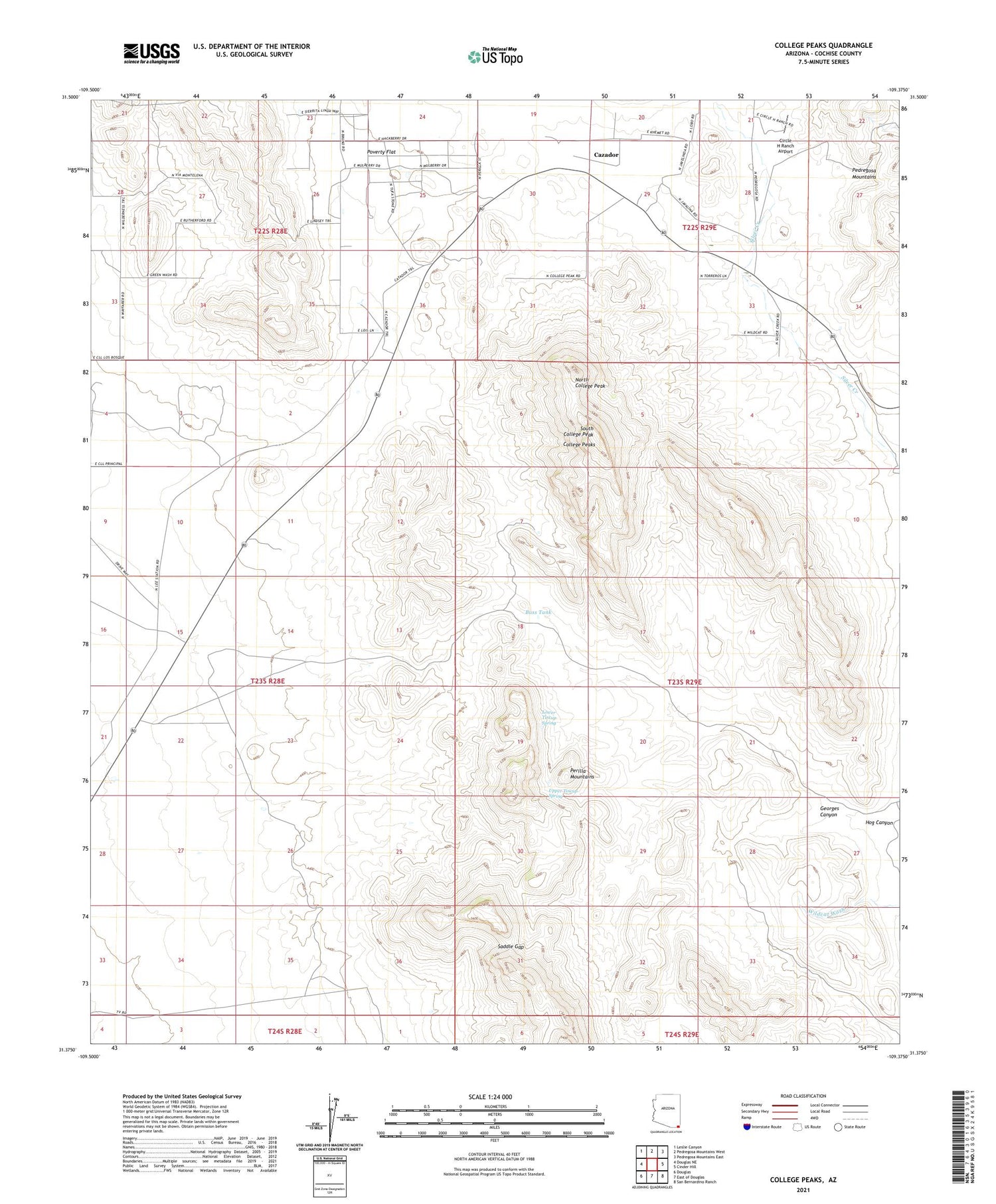
2021 topographic map quadrangle College Peaks in the state of Arizona. Scale: 1:24000. Based on the newly updated USGS 7.5' US Topo map series, this map is in the following counties: Cochise. The map contains contour data, water features, and other items you are used to seeing on USGS maps, but also has updated roads and other features. This is the next generation of topographic maps. Printed on high-quality waterproof paper with UV fade-resistant inks.
Quads adjacent to this one:
West: Douglas NE
Northwest: Leslie Canyon
North: Pedregosa Mountains West
Northeast: Pedregosa Mountains East
East: Cinder Hill
Southeast: San Bernardino Ranch
South: East of Douglas
Southwest: Douglas
This map covers the same area as the classic USGS quad with code o31109d4.
Contains the following named places: Bass Tank, Cazador, Circle H Ranch Airport, College Peaks, Douglas Division, Gardner Windmill, Georges Canyon, Hog Canyon, Johnson Windmill, Lease Windmill, Lower Hog Canyon Windmill, Lower Tincup Spring, New Windmill, North College Peak, Perilla Mountains, Poverty Flat, Saddle Gap, South College Peak, South Collge Peak, Turner Windmill, Upper Tincup Spring, Watson Windmill, Watt Windmill


