MyTopo
Douglas NE Arizona US Topo Map
Couldn't load pickup availability
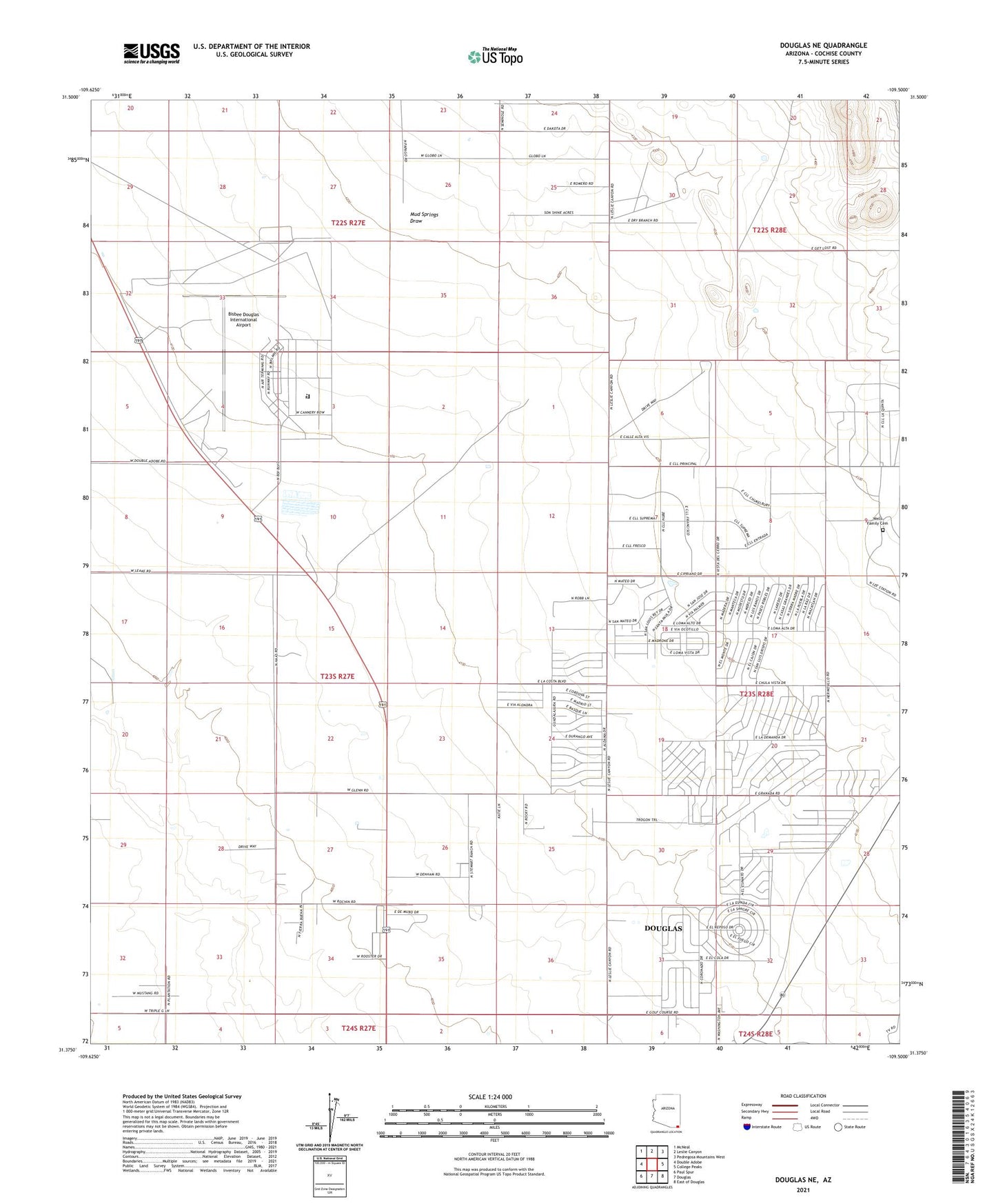
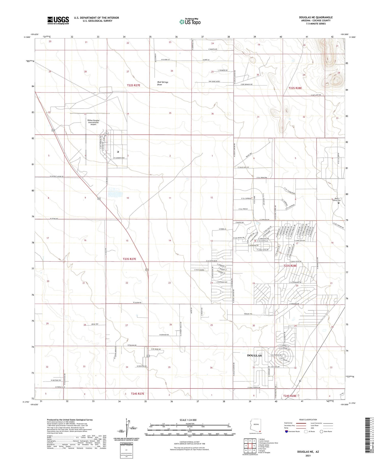
2021 topographic map quadrangle Douglas NE in the state of Arizona. Scale: 1:24000. Based on the newly updated USGS 7.5' US Topo map series, this map is in the following counties: Cochise. The map contains contour data, water features, and other items you are used to seeing on USGS maps, but also has updated roads and other features. This is the next generation of topographic maps. Printed on high-quality waterproof paper with UV fade-resistant inks.
Quads adjacent to this one:
West: Double Adobe
Northwest: McNeal
North: Leslie Canyon
Northeast: Pedregosa Mountains West
East: College Peaks
Southeast: East of Douglas
South: Douglas
Southwest: Paul Spur
This map covers the same area as the classic USGS quad with code o31109d5.
Contains the following named places: Arizona State Prison Complex Douglas, Bisbee Douglas International Airport, Cochise County Fairgrounds, Douglas Army Air Field, Douglas Golf Course, El Paso Natural Gas Company Compressor Station, Harris Ranch, Mount Vista Mobile Home Park, Mud Springs Draw, Puerto Cielo, Stewart Ranch, Watson Ranch, Wells Family Cemetery, Wells Ranch, ZIP Code: 85608