MyTopo
Elwood Canyon Arizona US Topo Map
Couldn't load pickup availability
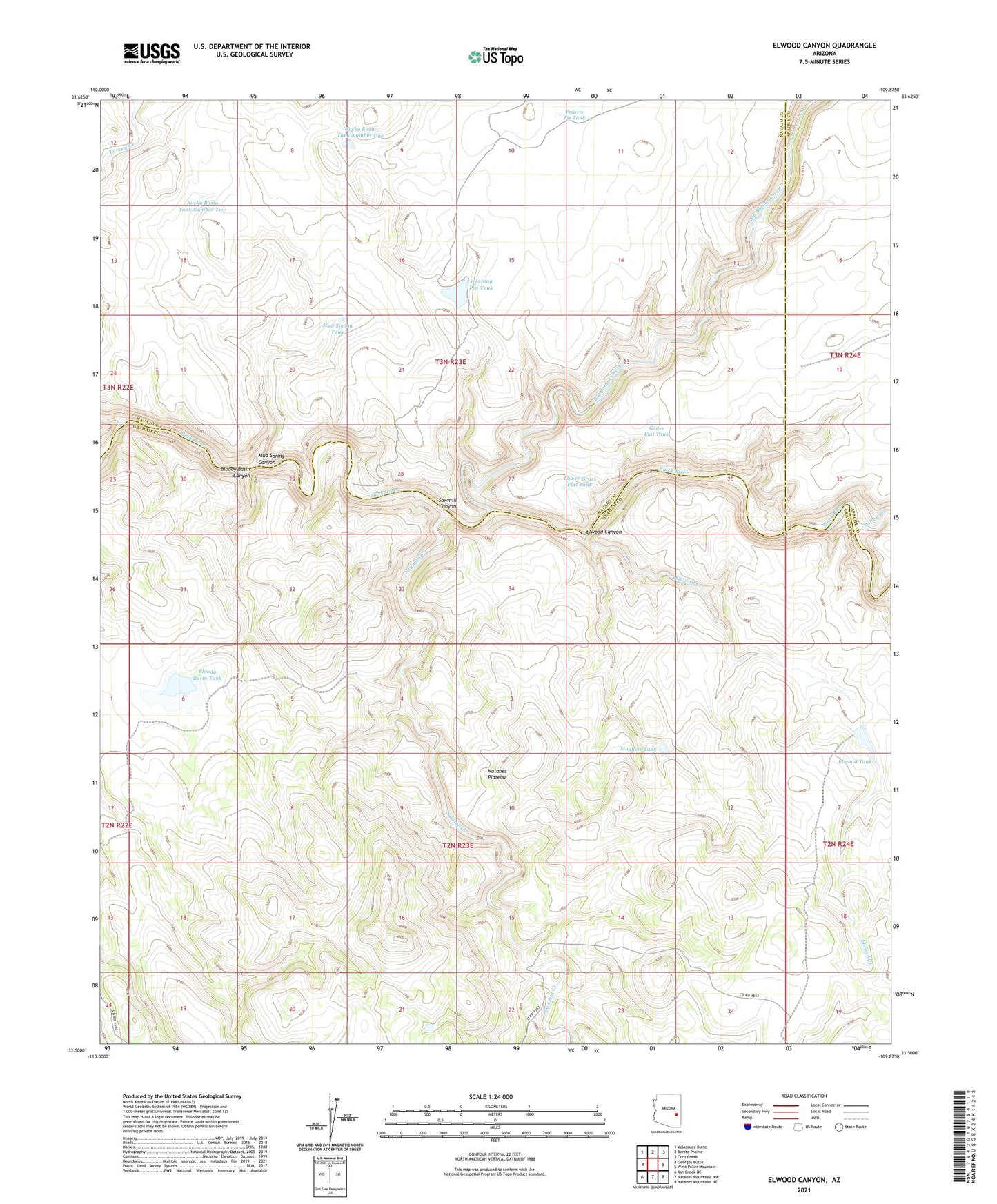
2021 topographic map quadrangle Elwood Canyon in the state of Arizona. Scale: 1:24000. Based on the newly updated USGS 7.5' US Topo map series, this map is in the following counties: Graham, Navajo, Apache. The map contains contour data, water features, and other items you are used to seeing on USGS maps, but also has updated roads and other features. This is the next generation of topographic maps. Printed on high-quality waterproof paper with UV fade-resistant inks.
Quads adjacent to this one:
West: Georges Butte
Northwest: Velasquez Butte
North: Bonito Prairie
Northeast: Corn Creek
East: West Poker Mountain
Southeast: Natanes Mountains NE
South: Natanes Mountains NW
Southwest: Ash Creek NE
This map covers the same area as the classic USGS quad with code o33109e8.
Contains the following named places: Big Bonito Creek, Bloody Basin Canyon, Bloody Basin Dam, Bloody Basin Tank, Elwood Canyon, Elwood Creek, Elwood Dam, Elwood Tank, Elwood Windmill, Grass Flat Tank, Hookers Gap Dam, Lower Grass Flat Tank, Mud Spring Canyon, Mud Spring Tank, Mudhole Tank, Natanes Plateau, Prairie Pit Tank, Rocky Basin Tank Number One, Rocky Basin Tank Number Two, Sawmill Canyon, Sawmill Creek, Turkey Creek, Weaning Pen Tank, Willow Creek