MyTopo
Bonito Prairie Arizona US Topo Map
Couldn't load pickup availability
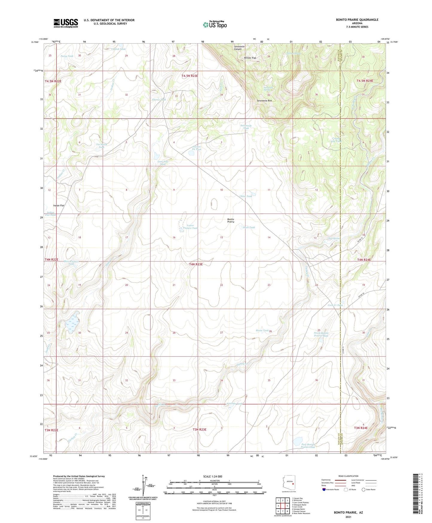
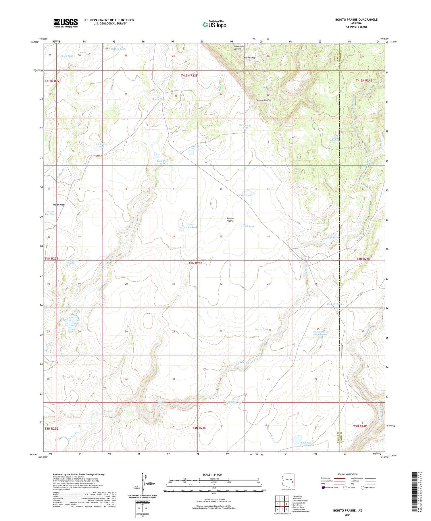
2021 topographic map quadrangle Bonito Prairie in the state of Arizona. Scale: 1:24000. Based on the newly updated USGS 7.5' US Topo map series, this map is in the following counties: Navajo, Apache. The map contains contour data, water features, and other items you are used to seeing on USGS maps, but also has updated roads and other features. This is the next generation of topographic maps. Printed on high-quality waterproof paper with UV fade-resistant inks.
Quads adjacent to this one:
West: Velasquez Butte
Northwest: Canyon Day
North: Whiteriver
Northeast: Corn Creek Plateau
East: Corn Creek
Southeast: West Poker Mountain
South: Elwood Canyon
Southwest: Georges Butte
This map covers the same area as the classic USGS quad with code o33109f8.
Contains the following named places: Antelope Tank, Bonito Prairie, Catfish Tank, Charco Tank, Chino Spring, Chino Spring Stockman Station, Chino Tank, Corn Creek, Corn Creek Tank, County Line Tank, Duck Tank, East Bonito Prairie Tank, Horse Tank, Indian Flat, Indian Flat Tank, Indian Flat Well, Lone Pine Tank, Lower Pasture Tank, Mare Pasture Tank, Nash Creek Dam, Navato Pit Tank, Norman Spring, North Bonito Prairie Tank, P Six Ranch, Pussy Tank, Sevenmile Spring, Sevenmile Tank, Tin Shack Tank, West Turkey Creek, Willow Trap