MyTopo
Fairbank Arizona US Topo Map
Couldn't load pickup availability
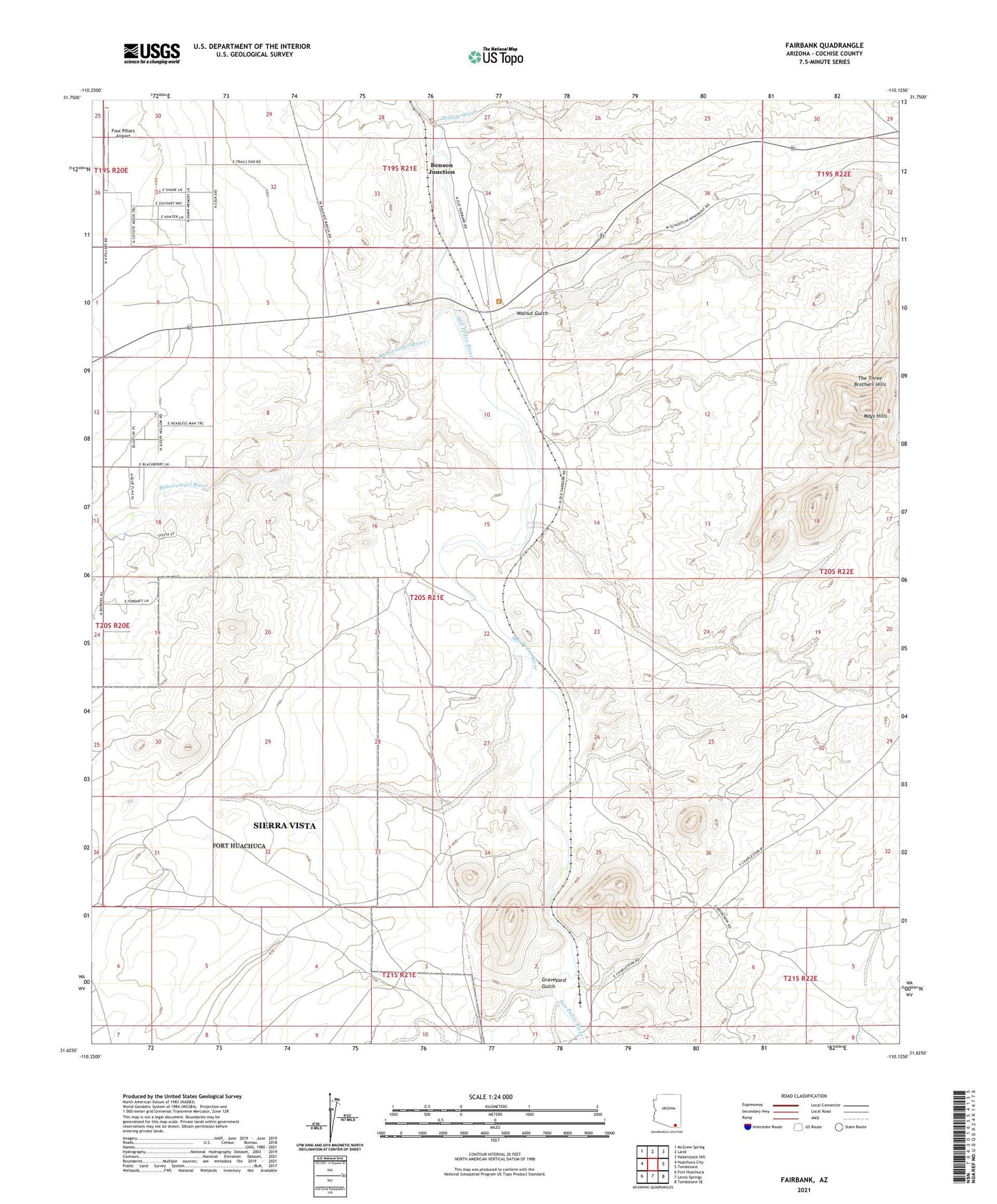
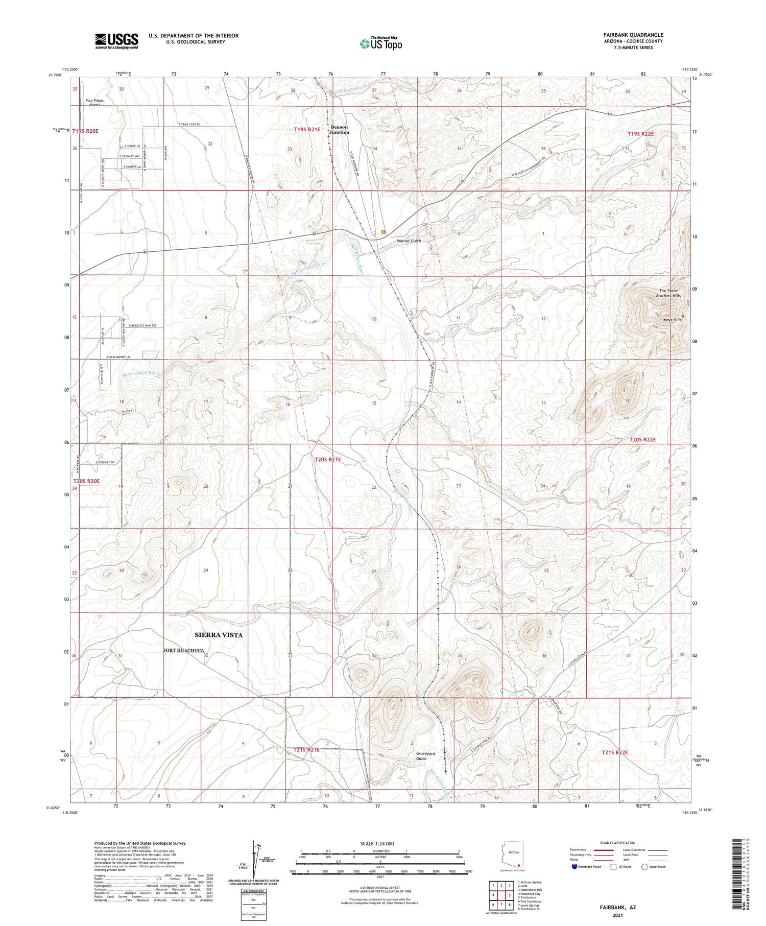
2021 topographic map quadrangle Fairbank in the state of Arizona. Scale: 1:24000. Based on the newly updated USGS 7.5' US Topo map series, this map is in the following counties: Cochise. The map contains contour data, water features, and other items you are used to seeing on USGS maps, but also has updated roads and other features. This is the next generation of topographic maps. Printed on high-quality waterproof paper with UV fade-resistant inks.
Quads adjacent to this one:
West: Huachuca City
Northwest: McGrew Spring
North: Land
Northeast: Haberstock Hill
East: Tombstone
Southeast: Tombstone SE
South: Lewis Springs
Southwest: Fort Huachuca
This map covers the same area as the classic USGS quad with code o31110f2.
Contains the following named places: Babocomari River, Benson Junction, Benson Junction Railroad Station, Boquillas Ranch, Buffalo Soldier Electronic Testing Range, Charleston, Charleston Lead Mine, Charleston Post Office, Fairbank, Fairbank Railroad Station, Four Pillars Airport, Graveyard Gulch, Lindsey Ranch, Mays Hills, San Juan de las Boguillas y Nogales, Sierra Vista Division, The Three Brothers Hills, Tombstone Territories Recreational Vehicle Resort, Walnut Gulch, Willow Wash