MyTopo
Huachuca City Arizona US Topo Map
Couldn't load pickup availability
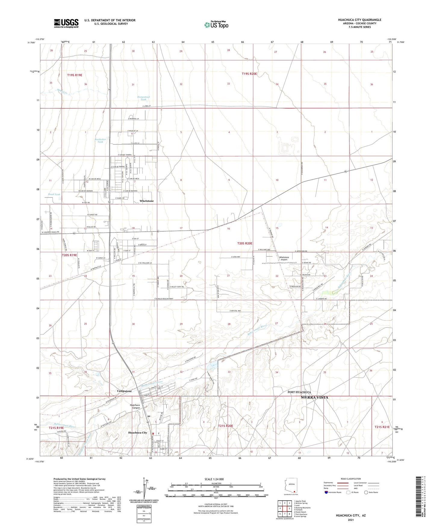
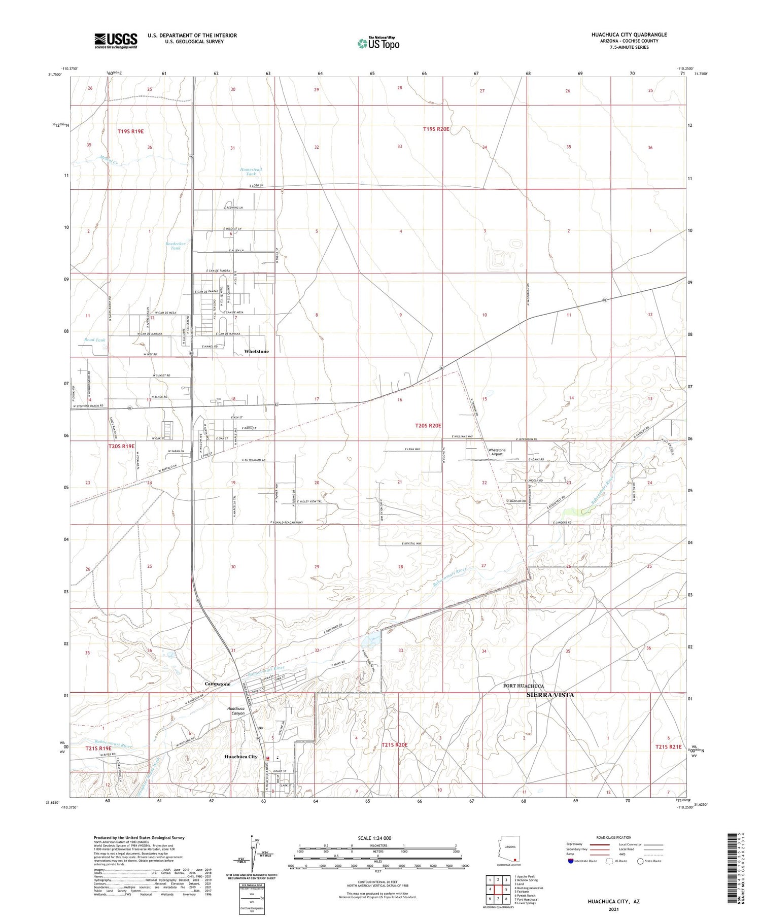
2021 topographic map quadrangle Huachuca City in the state of Arizona. Scale: 1:24000. Based on the newly updated USGS 7.5' US Topo map series, this map is in the following counties: Cochise. The map contains contour data, water features, and other items you are used to seeing on USGS maps, but also has updated roads and other features. This is the next generation of topographic maps. Printed on high-quality waterproof paper with UV fade-resistant inks.
Quads adjacent to this one:
West: Mustang Mountains
Northwest: Apache Peak
North: McGrew Spring
Northeast: Land
East: Fairbank
Southeast: Lewis Springs
South: Fort Huachuca
Southwest: Pyeatt Ranch
This map covers the same area as the classic USGS quad with code o31110f3.
Contains the following named places: Bethlehem Holy Ghost Church, Blacktail Wash, Boedecker Tank, Camp Wallen, Campstone, Church of Christ, Cochise County Western Regional Landfill, Fairbanks Park, Faith Baptist Church, Homestead Tank, Huachuca Canyon, Huachuca City, Huachuca City Fire Department, Huachuca City Landfill, Huachuca City Police Department, Huachuca City Post Office, Huachuca City Public Library, Huachuca City School, Huachuca Substation, Hunt Park, Hunt Ranch, Mescal Creek, Mountain View Recreational Vehicle Park, Road Tank, Rock Ranch, Slaughter House Wash, Town of Huachuca City, Whetstone, Whetstone Airport, Whetstone Census Designated Place, Whetstone Church of Christ, ZIP Code: 85616