MyTopo
Florence Arizona US Topo Map
Couldn't load pickup availability
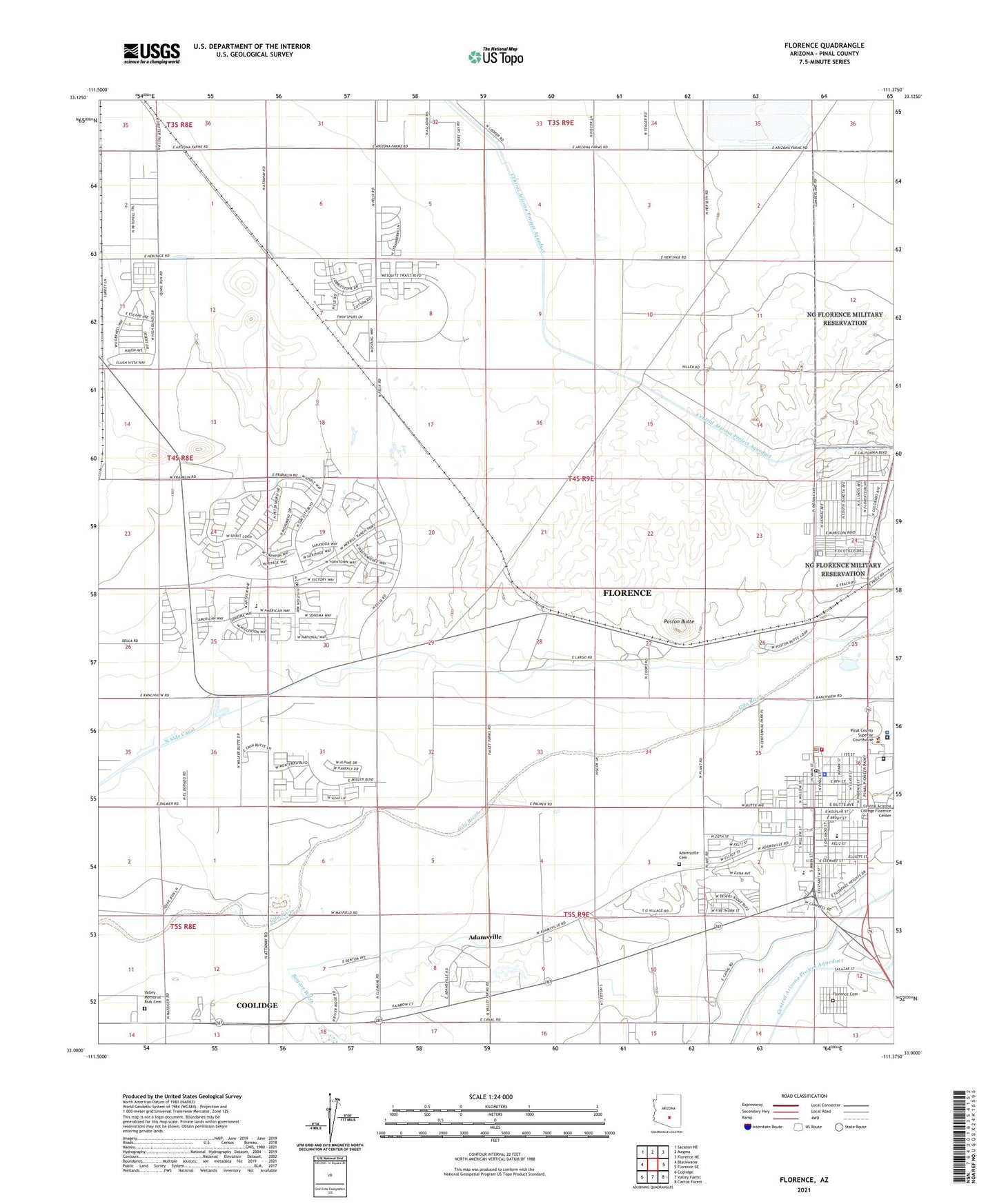
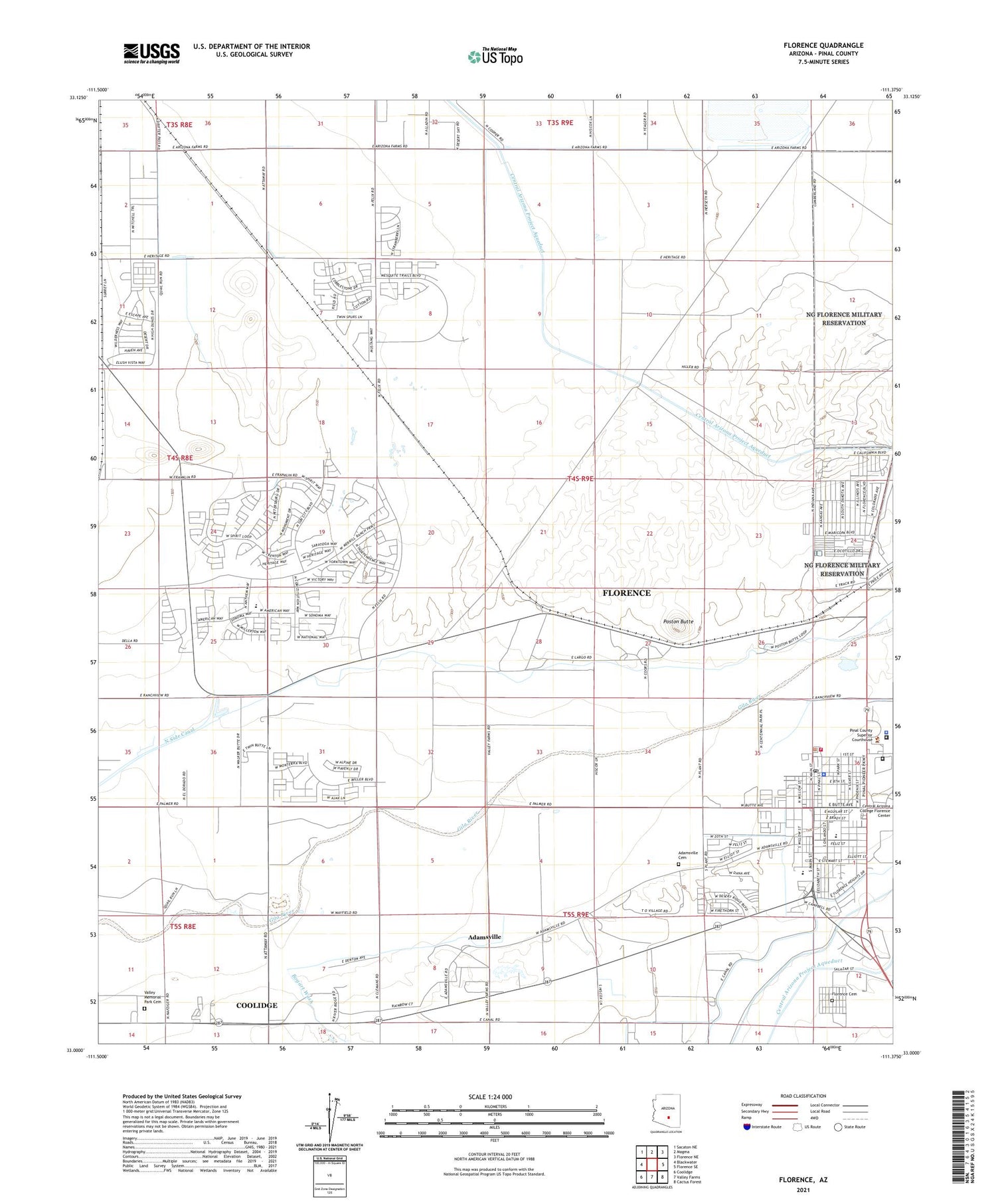
2021 topographic map quadrangle Florence in the state of Arizona. Scale: 1:24000. Based on the newly updated USGS 7.5' US Topo map series, this map is in the following counties: Pinal. The map contains contour data, water features, and other items you are used to seeing on USGS maps, but also has updated roads and other features. This is the next generation of topographic maps. Printed on high-quality waterproof paper with UV fade-resistant inks.
Quads adjacent to this one:
West: Blackwater
Northwest: Sacaton NE
North: Magma
Northeast: Florence NE
East: Florence SE
Southeast: Cactus Forest
South: Valley Farms
Southwest: Coolidge
This map covers the same area as the classic USGS quad with code o33111a4.
Contains the following named places: Adamsville, Adamsville Cemetery, Anthem K - 8 School, Arizona State Prison Florence West, Arriola Square, Bogart Wash, Dorothy Nolan Senior Center, First Presbyterian Church of Florence, Florence, Florence Baptist Church, Florence Cemetery, Florence Community Healthcare Facility, Florence Fire Department, Florence Gardens Mobile Home Park, Florence High School, Florence K - 8 School, Florence Police Department, Florence Post Office, Florence Station, Florence Town Hall, Highway Park, Ho Ho Kam Country Club, Magma Dam, North Side Canal, Oasis Golf Club, Pinal County Juvenile Detention Center, Pinal County Sheriff's Office, Poston Butte, Poston Butte Golf Club, The Church of Jesus Christ of Latter Day Saints, Three Parks Fairways, Town of Florence, Town of Florence North Florence Wastewater Treatment Plant, Town of Florence Wastewater Treatment Plant, Union Baptist Church, Valley Memorial Park Cemetery, Whispering Wind Mobile Home Park