MyTopo
Florence NE Arizona US Topo Map
Couldn't load pickup availability
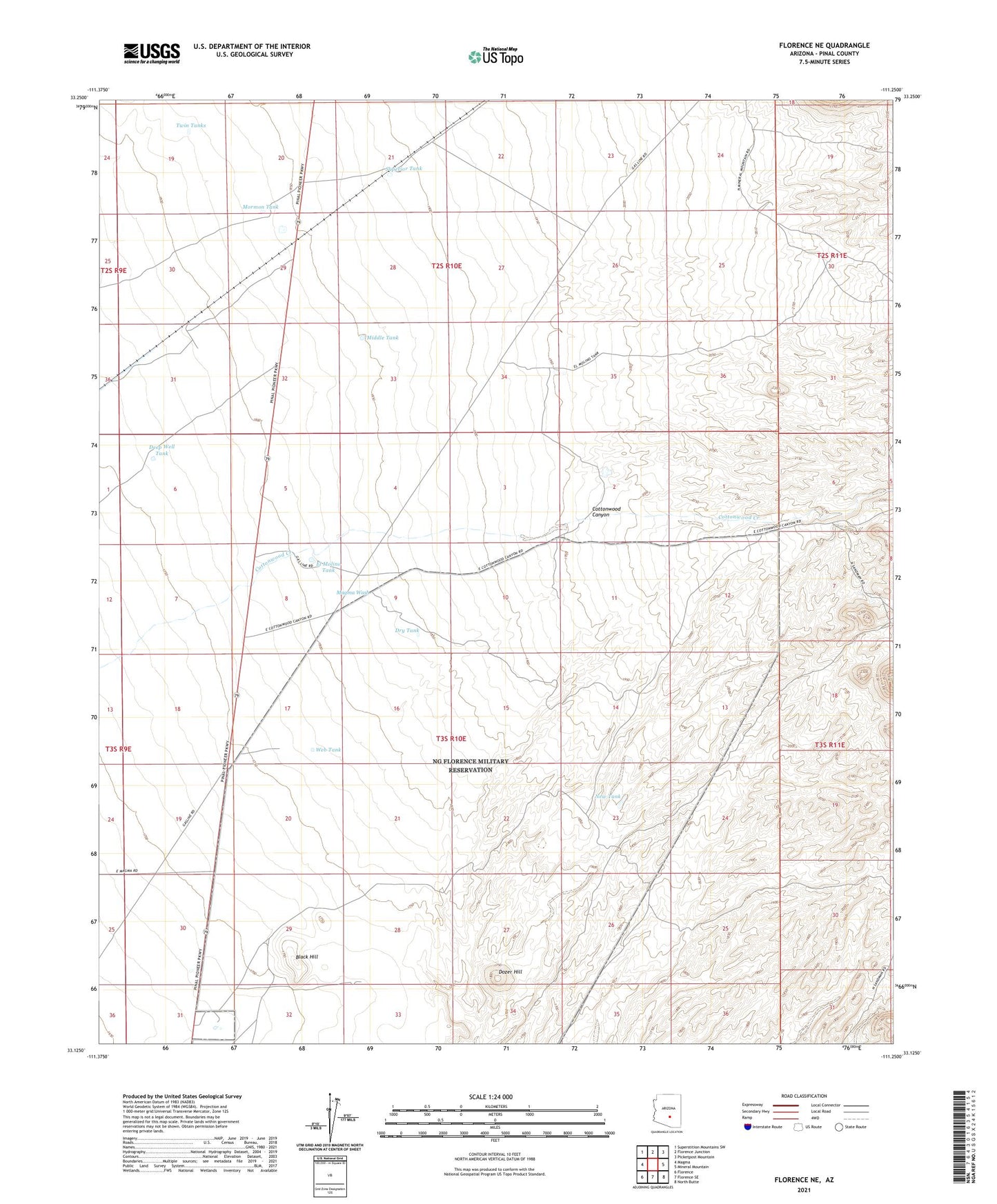
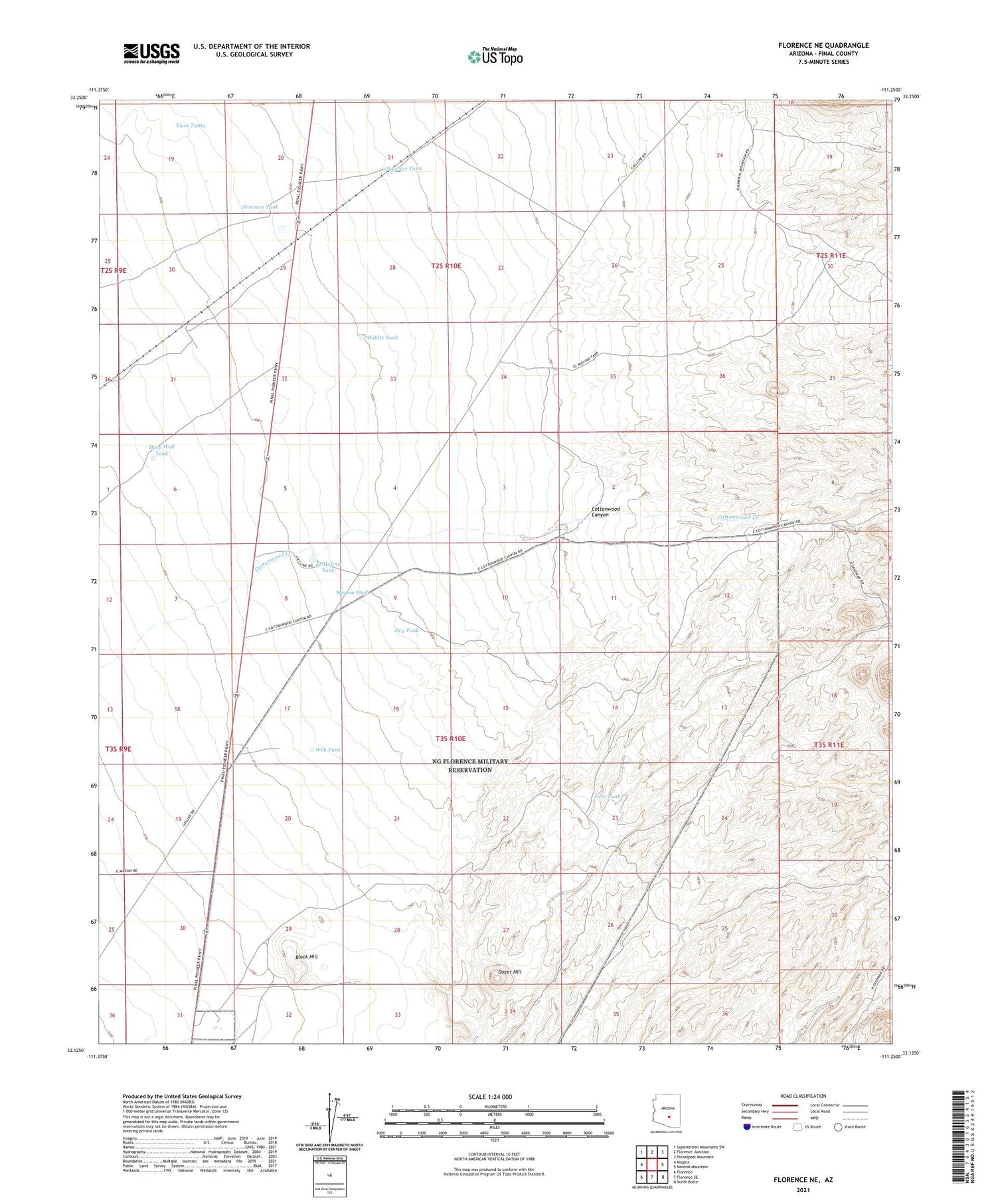
2021 topographic map quadrangle Florence NE in the state of Arizona. Scale: 1:24000. Based on the newly updated USGS 7.5' US Topo map series, this map is in the following counties: Pinal. The map contains contour data, water features, and other items you are used to seeing on USGS maps, but also has updated roads and other features. This is the next generation of topographic maps. Printed on high-quality waterproof paper with UV fade-resistant inks.
Quads adjacent to this one:
West: Magma
Northwest: Superstition Mountains SW
North: Florence Junction
Northeast: Picketpost Mountain
East: Mineral Mountain
Southeast: North Butte
South: Florence SE
Southwest: Florence
This map covers the same area as the classic USGS quad with code o33111b3.
Contains the following named places: Arizona Highway Department Oil Storage Tanks, Black Hill, Cottonwood Canyon, Deep Well Tank, Desert Well Number One, Desert Well Number Two, Dozer Hill, Dry Tank, El Molino Tank, Magma Wash, Middle Tank, Mormon Tank, New Tank, Superior Tank, Twin Tanks, Web Tank