MyTopo
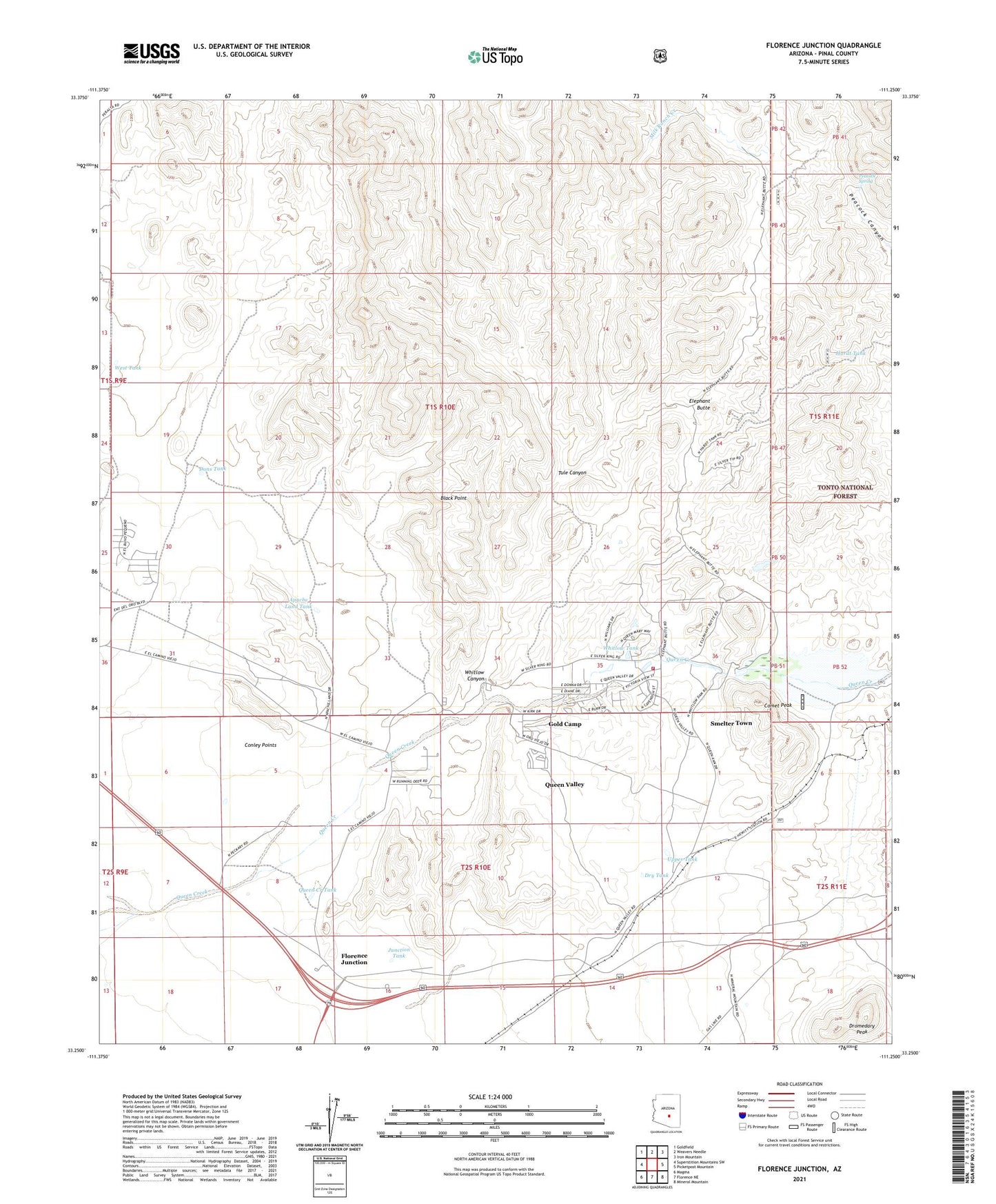
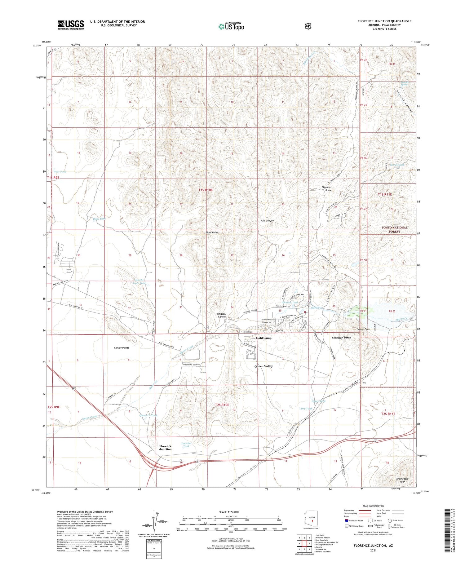
Florence Junction Arizona US Topo Map
Couldn't load pickup availability
Also explore the Florence Junction Forest Service Topo of this same quad for updated USFS data
2021 topographic map quadrangle Florence Junction in the state of Arizona. Scale: 1:24000. Based on the newly updated USGS 7.5' US Topo map series, this map is in the following counties: Pinal. The map contains contour data, water features, and other items you are used to seeing on USGS maps, but also has updated roads and other features. This is the next generation of topographic maps. Printed on high-quality waterproof paper with UV fade-resistant inks.
Quads adjacent to this one:
West: Superstition Mountains SW
Northwest: Goldfield
North: Weavers Needle
Northeast: Iron Mountain
East: Picketpost Mountain
Southeast: Mineral Mountain
South: Florence NE
Southwest: Magma
This map covers the same area as the classic USGS quad with code o33111c3.
Contains the following named places: Apache Land Tank, Arizona Highway Department Florence Junction Maintenance Camp, Black Point, Burns Ranch, Comet Peak, Conley Points, Dons Tank, Dromedary Peak, Dry Tank, Elephant Butte, Florence Junction, Florence Junction Airport, Gold Camp, Hardt Tank, Junction Tank, Milk Ranch, Milk Ranch Creek, North Pinal Division, Peacock Spring, Queen Creek Tank, Queen Valley, Queen Valley Census Designated Place, Queen Valley Estates, Queen Valley Fire District, Queen Valley Golf Course, San Mateo Castro Ranch, Smelter Town, Tule Canyon, Upper Tank, West Tank, Whitlow Canyon, Whitlow Ranch Dam, Whitlow Ranch Flood Control Basin, Whitlow Tank