
MyTopo
Columbia Arizona US Topo Map
Couldn't load pickup availability
Also explore the Columbia Forest Service Topo of this same quad for updated USFS data
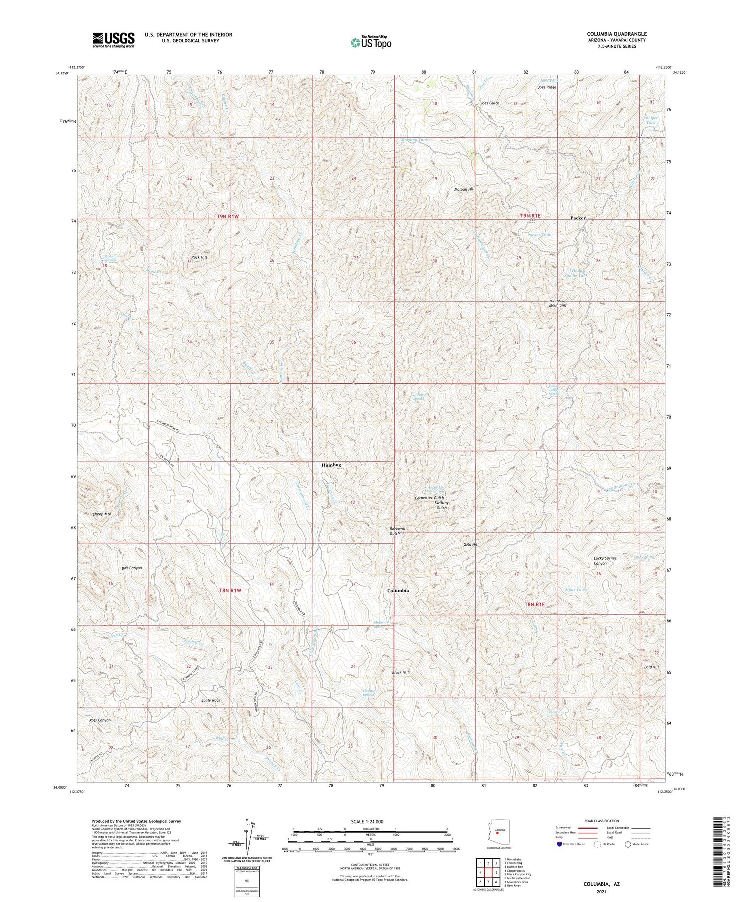
2021 topographic map quadrangle Columbia in the state of Arizona. Scale: 1:24000. Based on the newly updated USGS 7.5' US Topo map series, this map is in the following counties: Yavapai. The map contains contour data, water features, and other items you are used to seeing on USGS maps, but also has updated roads and other features. This is the next generation of topographic maps. Printed on high-quality waterproof paper with UV fade-resistant inks.
Quads adjacent to this one:
West: Copperopolis
Northwest: Minnehaha
North: Crown King
Northeast: Bumble Bee
East: Black Canyon City
Southeast: New River
South: Governors Peak
Southwest: Garfias Mountain
This map covers the same area as the classic USGS quad with code o34112a3.
Contains the following named places: Allen Mill Well, Ash Creek, Bald Hill, Black Hill, Box Canyon, Carpenter Gulch, Champie Ranch, Champie School, Columbia, Coolidge Mine, Copper Creek, Cottonwood Windmill, Cougar Mine, Crescent Mine, Doss Windmill, Eagle Rock, Fort Tule, Glint Mine, Gold Hill, Gold Spring Mine, Hardtimes Mine, Hesnnann Spring, Humbug, Jim Creek, Joes Gulch, Joes Tank, Juniper Tank, Little Joe Mine, Lizzie Lee Mine Spring, Lucky Mine, Lucky Spring, Lunan Mine, Malpais Hill, Milk Ranch, Mormon Tank, Mountain Springs, Mulberry Spring, Packer, Packer Tank, Pero Bonito Mine, Red Creek, Red Star Mine, Rock Hill, Rockwall Gulch, Rockwall Spring, Sand Creek, Seventysix Mine, Slims Tank, Swilling Gulch, Top Notch Mine, Tule Spring, Willow Creek, Windy Saddle Tank, Yellow Jacket Spring


