MyTopo
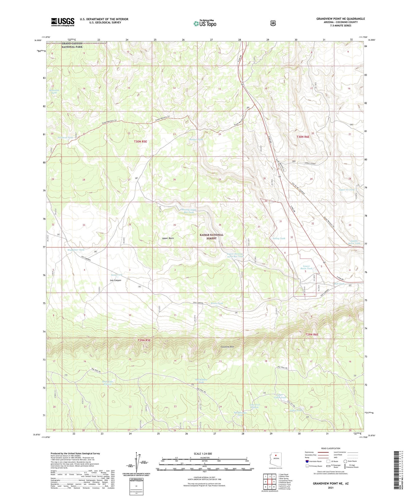
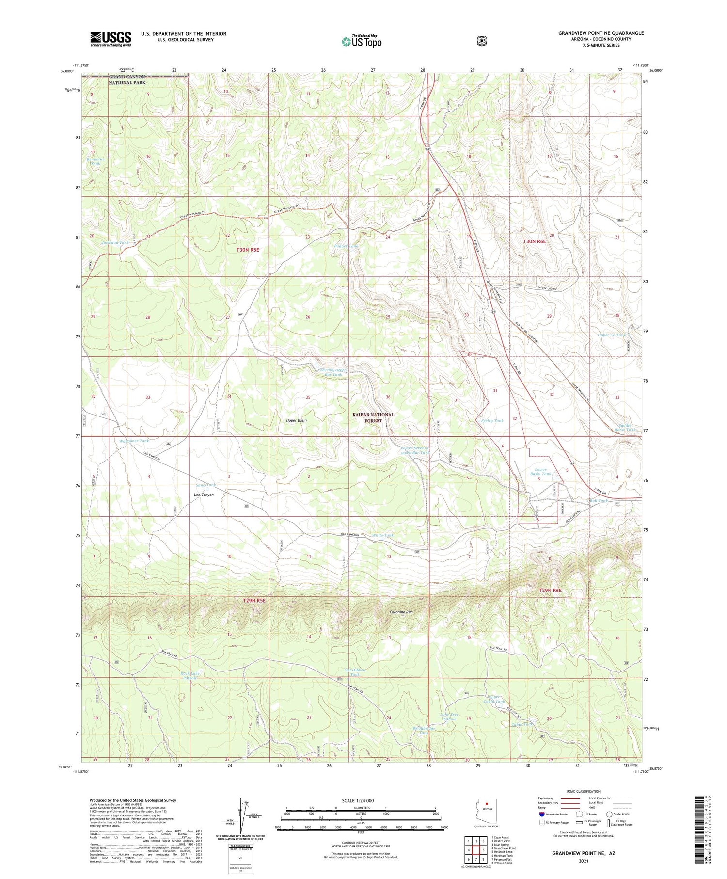
Grandview Point NE Arizona US Topo Map
Couldn't load pickup availability
Also explore the Grandview Point NE Forest Service Topo of this same quad for updated USFS data
2021 topographic map quadrangle Grandview Point NE in the state of Arizona. Scale: 1:24000. Based on the newly updated USGS 7.5' US Topo map series, this map is in the following counties: Coconino. The map contains contour data, water features, and other items you are used to seeing on USGS maps, but also has updated roads and other features. This is the next generation of topographic maps. Printed on high-quality waterproof paper with UV fade-resistant inks.
Quads adjacent to this one:
West: Grandview Point
Northwest: Cape Royal
North: Desert View
Northeast: Blue Spring
East: Hellhole Bend
Southeast: Willows Camp
South: Peterson Flat
Southwest: Harbison Tank
This map covers the same area as the classic USGS quad with code o35111h7.
Contains the following named places: Badger Tank, Bentonite Tank, Buff Tank, Bull Tank, Cabin Tank, Deer Tank, Deer Tank Wash, Deer Wash Tank, Freshour Tank, Jackman Tank, Lone Tree Pothole, Long Tree Pothole, Long Tree Tank, Lower Basin Tank, Lower Seventy-seven Bar Tank, Old Hibben Tank, Rock Lake Pothole, Saddle Horse Tank, Sand Tank, Seeley Tank, Seventy-seven Bar Tank, Upper Basin, Upper Cabin Tank, Upper Co Tank, Upper Saddle Horse Tank, Waggoner Tank, Watts Tank, Woodbridge Tank