MyTopo
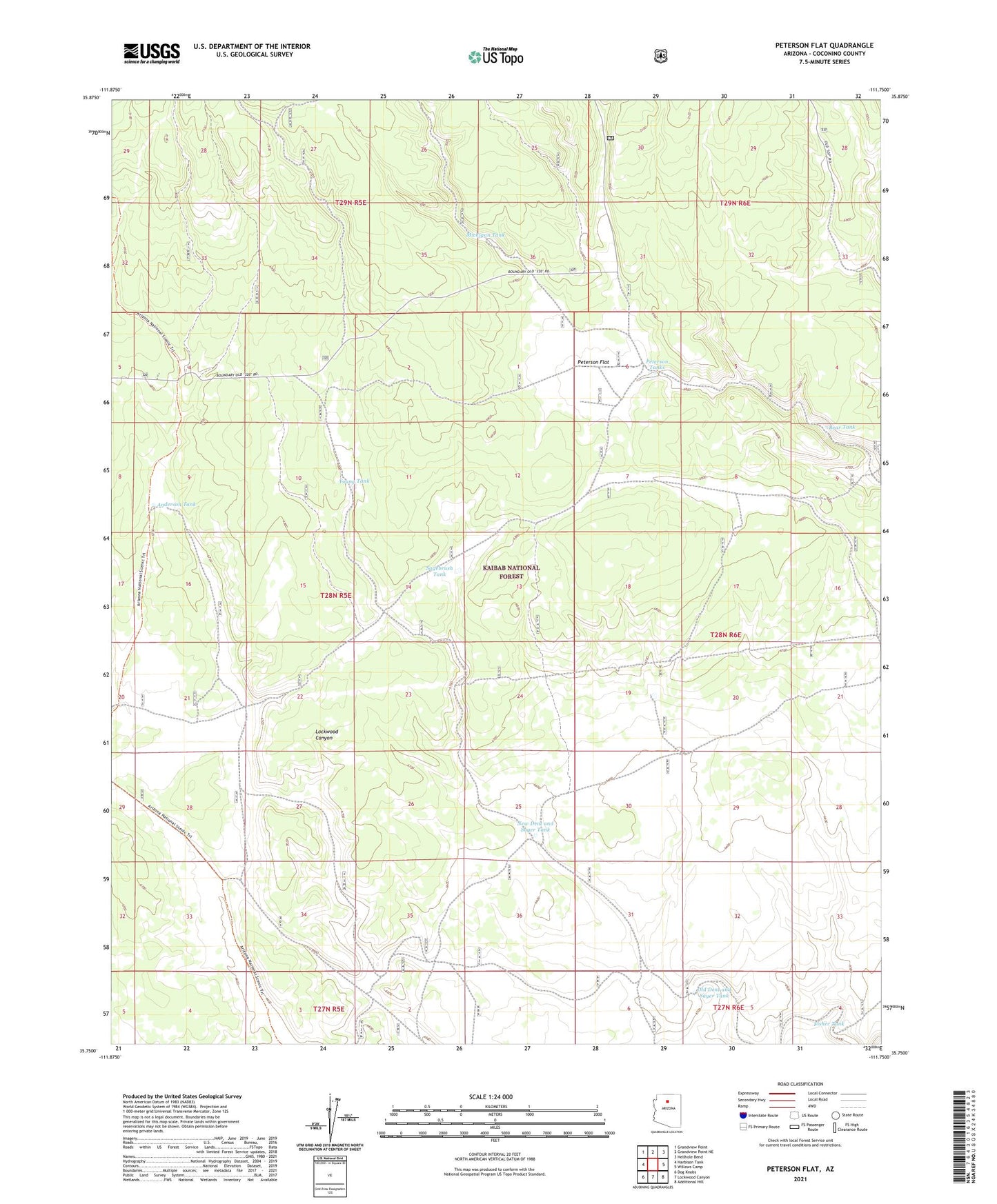
Peterson Flat Arizona US Topo Map
Couldn't load pickup availability
Also explore the Peterson Flat Forest Service Topo of this same quad for updated USFS data
2021 topographic map quadrangle Peterson Flat in the state of Arizona. Scale: 1:24000. Based on the newly updated USGS 7.5' US Topo map series, this map is in the following counties: Coconino. The map contains contour data, water features, and other items you are used to seeing on USGS maps, but also has updated roads and other features. This is the next generation of topographic maps. Printed on high-quality waterproof paper with UV fade-resistant inks.
Quads adjacent to this one:
West: Harbison Tank
Northwest: Grandview Point
North: Grandview Point NE
Northeast: Hellhole Bend
East: Willows Camp
Southeast: Additional Hill
South: Lockwood Canyon
Southwest: Dog Knobs
This map covers the same area as the classic USGS quad with code o35111g7.
Contains the following named places: Anderson Tank, Banks Tank, Bear Tank, Blowout Water Storage Tank, Coconino County, Della Water Storage Tank, Dillman Water Storage Tank, Fisher Tank, Michigan Tank, New Dent and Sayer Tank, Old Dent and Sayer Tank, Peterson Flat, Peterson Tanks, Peterson Water Storage Tank, Russell Water Storage Tank, Sagebrush Tank, Skousen Tank, Water Haul Tank, Young Tank