MyTopo
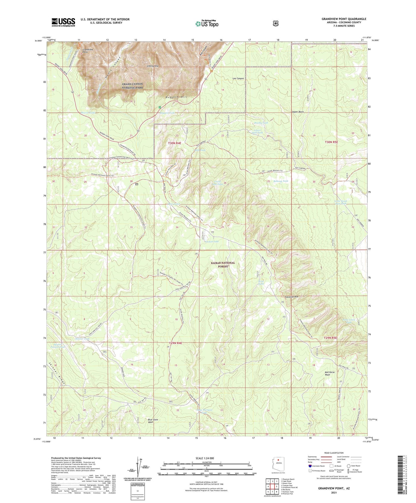
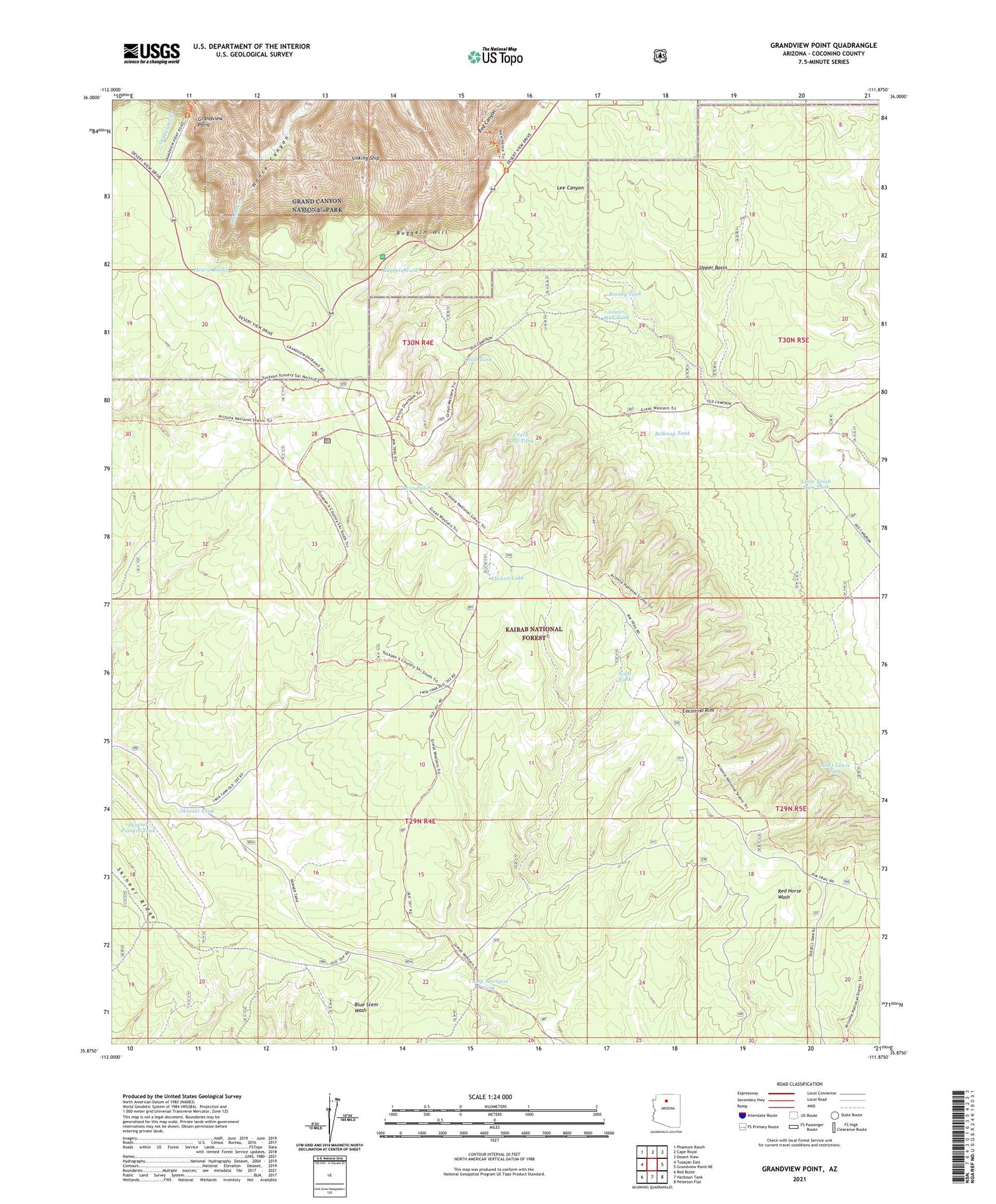
Grandview Point Arizona US Topo Map
Couldn't load pickup availability
Also explore the Grandview Point Forest Service Topo of this same quad for updated USFS data
2021 topographic map quadrangle Grandview Point in the state of Arizona. Scale: 1:24000. Based on the newly updated USGS 7.5' US Topo map series, this map is in the following counties: Coconino. The map contains contour data, water features, and other items you are used to seeing on USGS maps, but also has updated roads and other features. This is the next generation of topographic maps. Printed on high-quality waterproof paper with UV fade-resistant inks.
Quads adjacent to this one:
West: Tusayan East
Northwest: Phantom Ranch
North: Cape Royal
Northeast: Desert View
East: Grandview Point NE
Southeast: Peterson Flat
South: Harbison Tank
Southwest: Red Butte
This map covers the same area as the classic USGS quad with code o35111h8.
Contains the following named places: Arizona Trail, Belknap Tank, Brushy Tank, Buggeln Hill, Buggeln Tank, Camp Thirtysix Tank, Crazy Cow Tank, Grandview Lookout Tower, Grandview Point, Hearst Tanks, Hull Cabin, Hull Tank, Hull Tank Ranger Station, Little Trash Dam, Little Trash Dam Tank, Lockett Lake, Lower Hull Tank, Newt Lewis Tank, Scott Tank, Sinking Ship, Skinner Pasture Tank, Skinner Tank, Skinner Trick Tank, South Rim, Trash Dam, Tusayan Ranger District, Twin Lakes, Upper Lee Trick Tank