MyTopo
Grayback Arizona US Topo Map
Couldn't load pickup availability
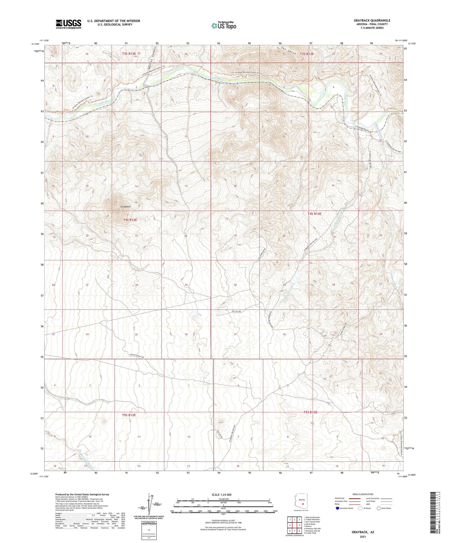
2021 topographic map quadrangle Grayback in the state of Arizona. Scale: 1:24000. Based on the newly updated USGS 7.5' US Topo map series, this map is in the following counties: Pinal. The map contains contour data, water features, and other items you are used to seeing on USGS maps, but also has updated roads and other features. This is the next generation of topographic maps. Printed on high-quality waterproof paper with UV fade-resistant inks.
Quads adjacent to this one:
West: North Butte
Northwest: Mineral Mountain
North: Teapot Mountain
Northeast: Hot Tamale Peak
East: Kearny
Southeast: Crozier Peak
South: Ninetysix Hills NE
Southwest: Ninetysix Hills NW
This map covers the same area as the classic USGS quad with code o33111a1.
Contains the following named places: A-Diamond Ranch, Golden Bell Mine, Grayback, KGUS-AM (Florence), Peg Leg Well, Ripsey Wash, Tea Cup Ranch, Walnut Canyon, Wooley Mine, Wooley Railroad Station, Zelleweger Wash