MyTopo
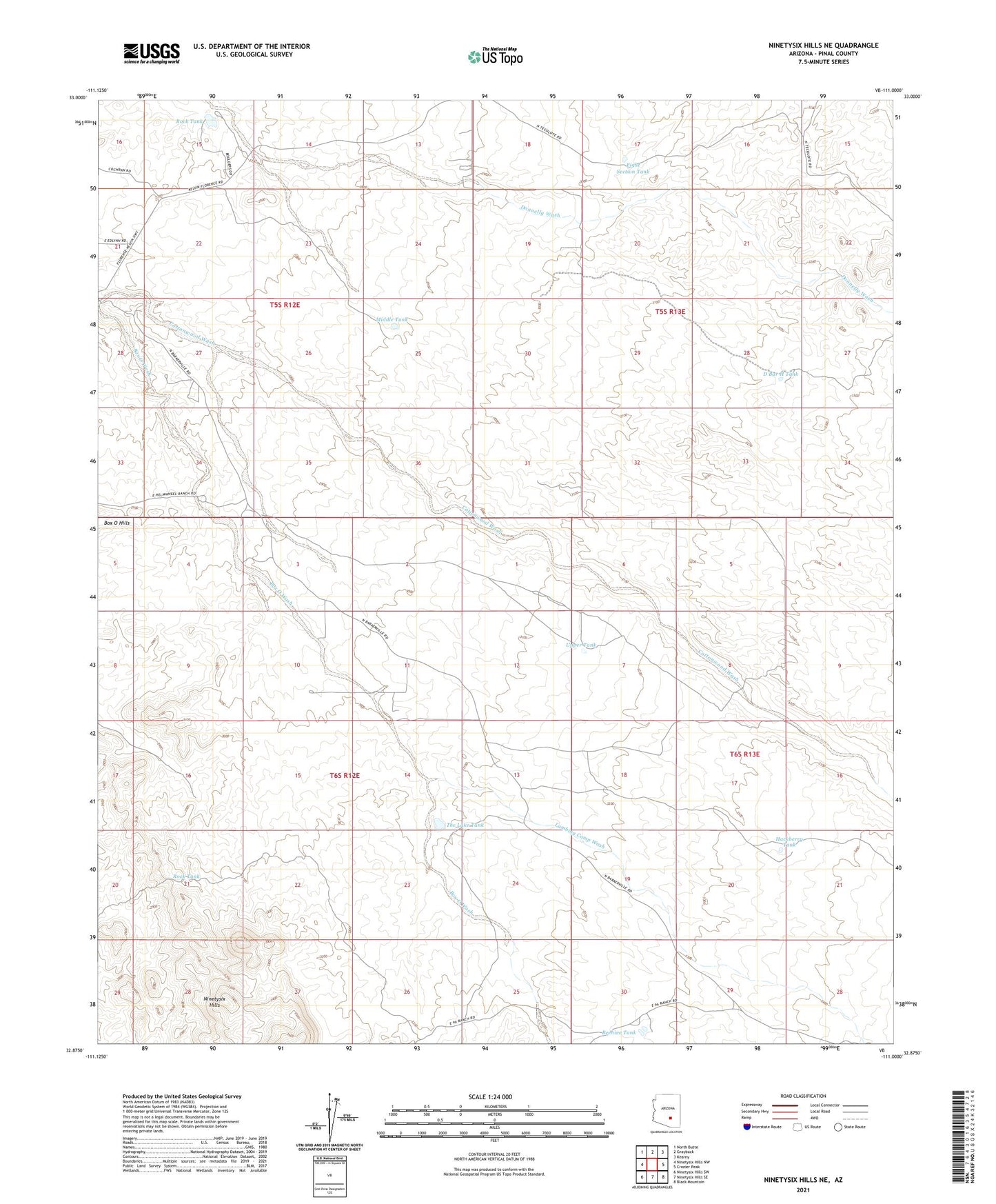
Ninetysix Hills NE Arizona US Topo Map
Couldn't load pickup availability
2021 topographic map quadrangle Ninetysix Hills NE in the state of Arizona. Scale: 1:24000. Based on the newly updated USGS 7.5' US Topo map series, this map is in the following counties: Pinal. The map contains contour data, water features, and other items you are used to seeing on USGS maps, but also has updated roads and other features. This is the next generation of topographic maps. Printed on high-quality waterproof paper with UV fade-resistant inks.
Quads adjacent to this one:
West: Ninetysix Hills NW
Northwest: North Butte
North: Grayback
Northeast: Kearny
East: Crozier Peak
Southeast: Black Mountain
South: Ninetysix Hills SE
Southwest: Ninetysix Hills SW
This map covers the same area as the classic USGS quad with code o32111h1.
Contains the following named places: Beehive Tank, Box O Ranch, Casa Grande Turbine Station, Cottonwood Wash, D Bar H Tank, Eight Section Tank, Hackberry Tank, Helmwheel Ranch, Horse Ranch, Lambing Camp Wash, Middle Tank, Ninetysix Hills, Rock Tank, The Lake Tank, Upper Tank