
MyTopo
Kearny Arizona US Topo Map
Couldn't load pickup availability
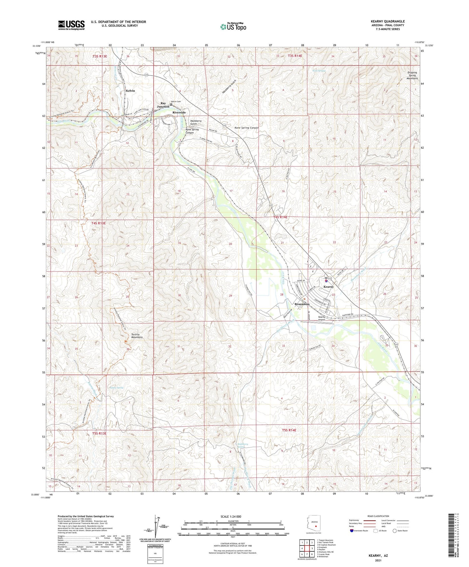
2021 topographic map quadrangle Kearny in the state of Arizona. Scale: 1:24000. Based on the newly updated USGS 7.5' US Topo map series, this map is in the following counties: Pinal. The map contains contour data, water features, and other items you are used to seeing on USGS maps, but also has updated roads and other features. This is the next generation of topographic maps. Printed on high-quality waterproof paper with UV fade-resistant inks.
Quads adjacent to this one:
West: Grayback
Northwest: Teapot Mountain
North: Hot Tamale Peak
Northeast: El Capitan Mountain
East: Hayden
Southeast: Winkelman
South: Crozier Peak
Southwest: Ninetysix Hills NE
This map covers the same area as the classic USGS quad with code o33110a8.
Contains the following named places: Arthur E Pomeroy Public Library, Branaman, Breezeway Trailer Park, Church of the Good Shepherd, Fellowship Baptist Church, Hackberry Gulch, Hackberry Mine, Hackberry Spring, Hackberry Wash, Indian Camp Wash, Jim Thomas Wash, Kane Spring Canyon, Kane Springs, Kearny, Kearny Airport, Kearny Church of Christ, Kearny Fire Department, Kearny Golf Course, Kearny Mobile Home Park, Kearny Municipal Pool, Kearny Police Department, Kearny Post Office, Kearny Southern Baptist Church, Kearny Water Reclamation Facility, Kelvin, Kelvin Cemetery, Kennecott Cooper Corporation Hospital, Mineral Creek, Old Ripsey Mine, Pinal County Sheriff's Office, Ray Elementary School, Ray High School, Ray Junction, Ray Primary School, Ripsey Spring, Riverside, Saguaro Mobile Home Park, Steamboat Wash, Sultana-Arizona Mine, Town of Kearny


