MyTopo
Guthrie Arizona US Topo Map
Couldn't load pickup availability
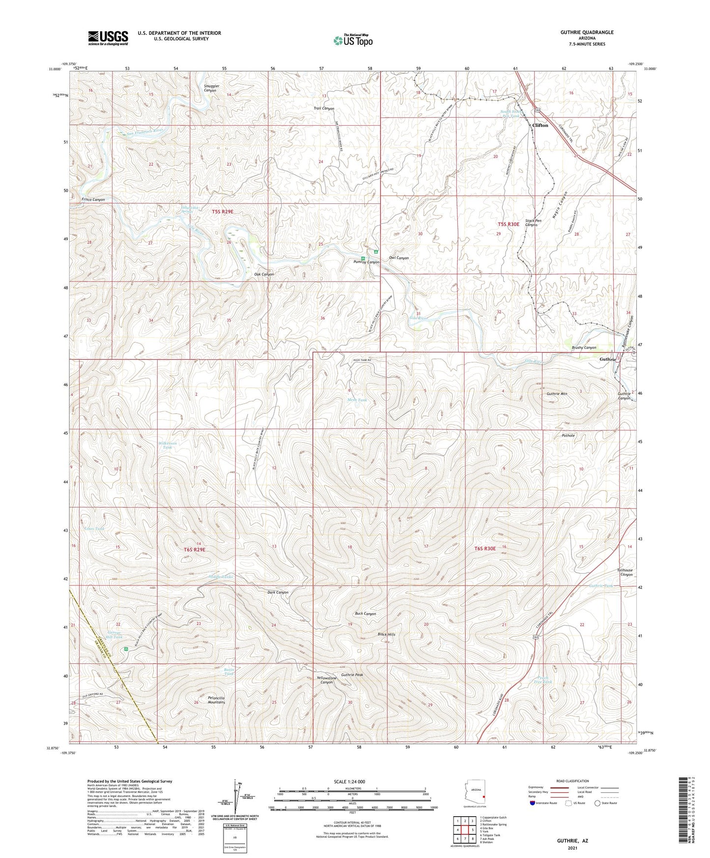
2021 topographic map quadrangle Guthrie in the state of Arizona. Scale: 1:24000. Based on the newly updated USGS 7.5' US Topo map series, this map is in the following counties: Greenlee, Graham. The map contains contour data, water features, and other items you are used to seeing on USGS maps, but also has updated roads and other features. This is the next generation of topographic maps. Printed on high-quality waterproof paper with UV fade-resistant inks.
Quads adjacent to this one:
West: Gila Box
Northwest: Copperplate Gulch
North: Clifton
Northeast: Rattlesnake Spring
East: York
Southeast: Sheldon
South: Ash Peak
Southwest: Tollgate Tank
This map covers the same area as the classic USGS quad with code o32109h3.
Contains the following named places: Aragon Place, Basin Tank, Brushy Canyon, Clay Tank, Dark Canyon, Frisco Canyon, George Hill Tank, Gillard Hot Springs, Guthrie, Guthrie Canyon, Guthrie Mountain, Guthrie Peak, Guthrie Railroad Station, Guthrie Tank, KFMM-FM (Thatcher), KJJJ-FM (Clifton), Lines Tank, Maques Place, Mesa Tank, Negro Canyon, Oak Canyon, Old Zorilla Ranch, Owl Canyon, Peach Tree Tank, Pothole, Pumroy Canyon, Rattlesnake Canyon, Saddle Tanks, San Francisco River, Smuggler Canyon, Smuggler Mine, South Stock Pen Tank, Stock Pen Canyon, Stock Pen Tank, Subia Ranch, Wilkerson Ranch, Wilkerson Tank