MyTopo
Gyp Pocket Arizona US Topo Map
Couldn't load pickup availability
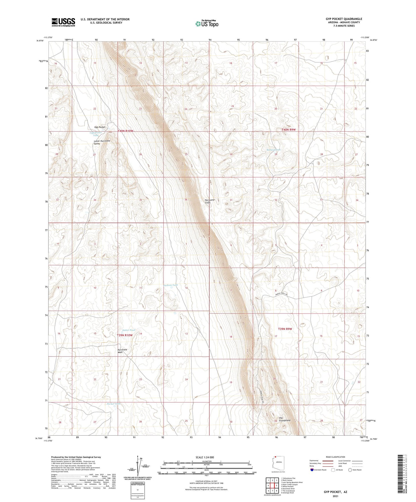
2021 topographic map quadrangle Gyp Pocket in the state of Arizona. Scale: 1:24000. Based on the newly updated USGS 7.5' US Topo map series, this map is in the following counties: Mohave. The map contains contour data, water features, and other items you are used to seeing on USGS maps, but also has updated roads and other features. This is the next generation of topographic maps. Printed on high-quality waterproof paper with UV fade-resistant inks.
Quads adjacent to this one:
West: Hole-n-Wall Canyon
Northwest: Yellowhorse Flat
North: Rock Canyon
Northeast: Lost Spring Mountain West
East: White Pockets
Southeast: Antelope Knoll
South: The Grandstand
Southwest: Dutchman Draw
This map covers the same area as the classic USGS quad with code o36113g3.
Contains the following named places: Ballard Tank, Black Canyon Windmill, Gyp Pocket, Gyp Pocket Tank, Jackson Tank, Lower Hurricane Valley, Nutter Pond, Parker Tank, Temple Trail