MyTopo
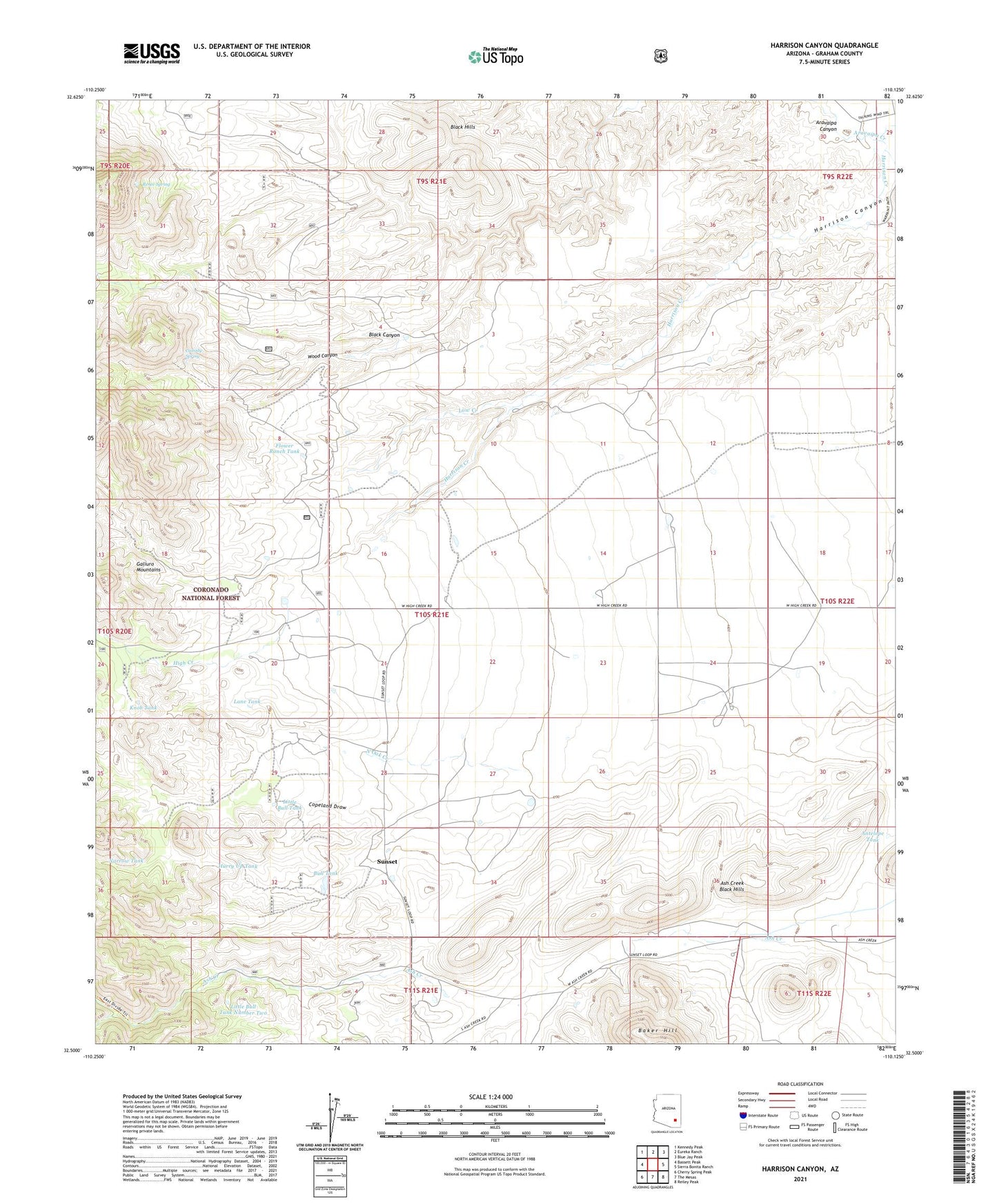
Harrison Canyon Arizona US Topo Map
Couldn't load pickup availability
Also explore the Harrison Canyon Forest Service Topo of this same quad for updated USFS data
2021 topographic map quadrangle Harrison Canyon in the state of Arizona. Scale: 1:24000. Based on the newly updated USGS 7.5' US Topo map series, this map is in the following counties: Graham. The map contains contour data, water features, and other items you are used to seeing on USGS maps, but also has updated roads and other features. This is the next generation of topographic maps. Printed on high-quality waterproof paper with UV fade-resistant inks.
Quads adjacent to this one:
West: Bassett Peak
Northwest: Kennedy Peak
North: Eureka Ranch
Northeast: Blue Jay Peak
East: Sierra Bonita Ranch
Southeast: Reiley Peak
South: The Mesas
Southwest: Cherry Spring Peak
This map covers the same area as the classic USGS quad with code o32110e2.
Contains the following named places: Antelope Tank, Ash Creek Black Hills, Bosley Ranch, Buckskin Ranch, Bull Ranch, Bull Tank, Byrd Ranch, Cassidy Spring, Copeland Draw, De Borde Ranch, Flower Ranch Tank, Fulmer Ranch, Harrison Canyon, Harrison Canyon Dam, Hurry Up Tank, Knob Tank, Lane Tank, Little Bull Tank, Little Bull Tank Number Two, Low Creek, McGee Windmill, Narrow Tank, North Oak Creek, Oak Creek Dam, Renee Spring, Rincon Dam, South Fork Ash Creek, South Oak Creek, Southern Tank, Sunset, Sunset Valley Ranch, Wood Canyon