MyTopo
Reiley Peak Arizona US Topo Map
Couldn't load pickup availability
Also explore the Reiley Peak Forest Service Topo of this same quad for updated USFS data
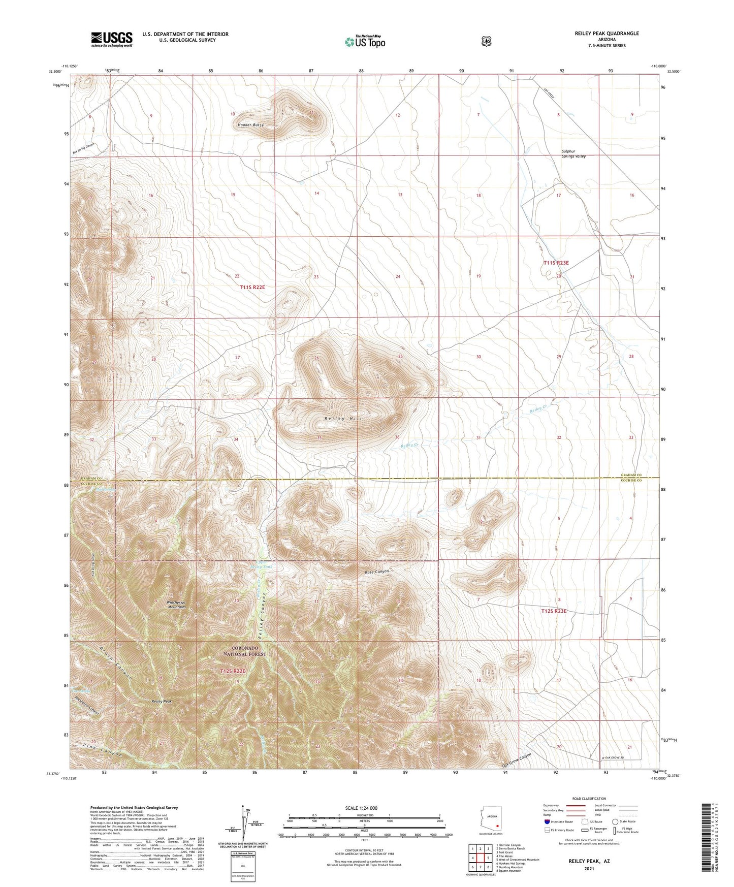
2021 topographic map quadrangle Reiley Peak in the state of Arizona. Scale: 1:24000. Based on the newly updated USGS 7.5' US Topo map series, this map is in the following counties: Cochise, Graham. The map contains contour data, water features, and other items you are used to seeing on USGS maps, but also has updated roads and other features. This is the next generation of topographic maps. Printed on high-quality waterproof paper with UV fade-resistant inks.
Quads adjacent to this one:
West: The Mesas
Northwest: Harrison Canyon
North: Sierra Bonita Ranch
Northeast: Fort Grant
East: West of Greasewood Mountain
Southeast: Square Mountain
South: Muskhog Mountain
Southwest: Hookers Hot Springs
This map covers the same area as the classic USGS quad with code o32110d1.
Contains the following named places: Box Spring Canyon, Box Spring Creek, Froelich Ranch, Hooker Butte, Lightning Ranch Airstrip, Mud Springs, Mud Springs Canyon, Mud Springs Wash, Oak Grove Canyon, Poer Spring, Reiley Canyon, Reiley Creek, Reiley Hill, Reiley Peak, Rose Canyon, Rose Tank, Upper Reiley Tank