MyTopo
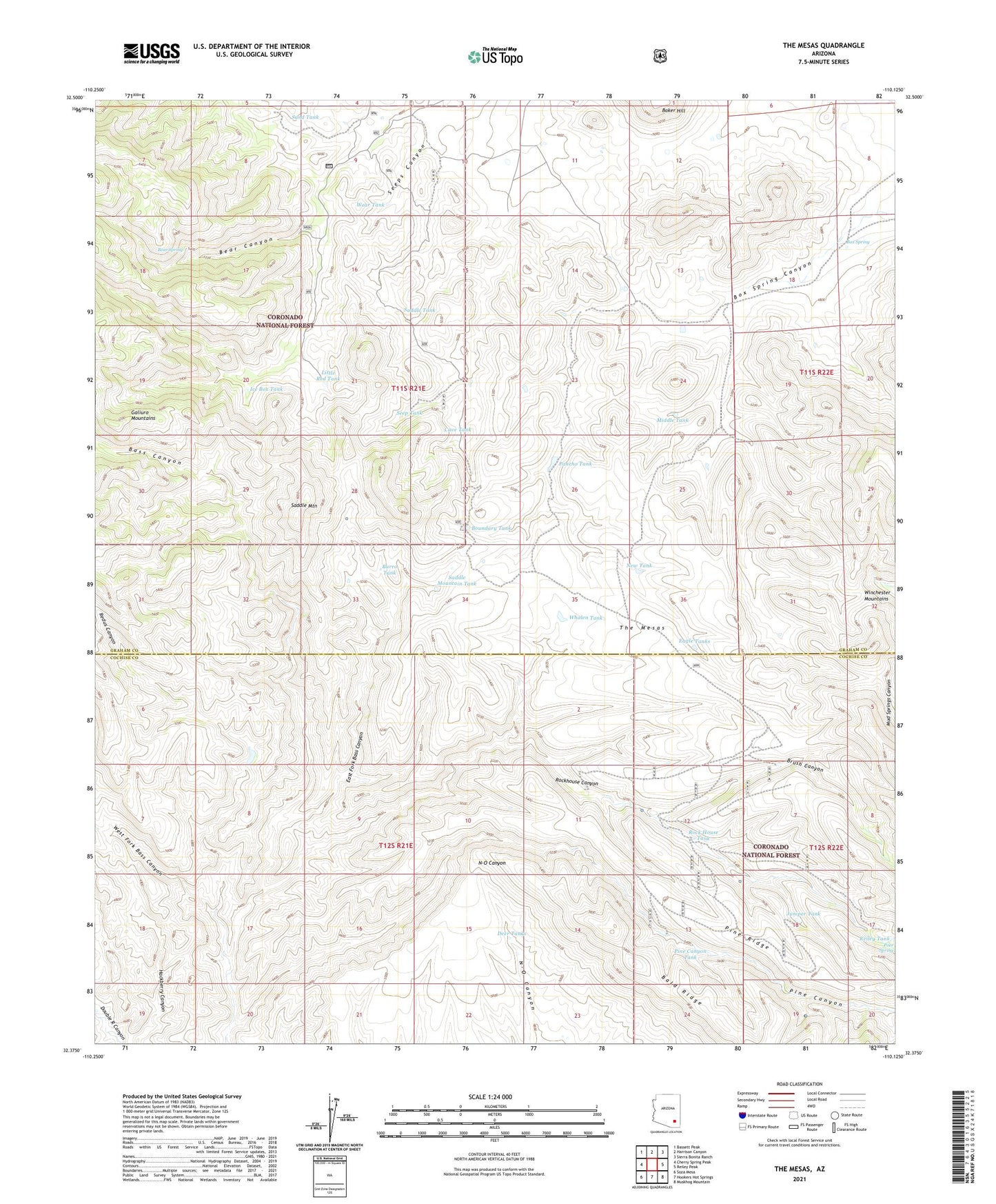
The Mesas Arizona US Topo Map
Couldn't load pickup availability
Also explore the The Mesas Forest Service Topo of this same quad for updated USFS data
2021 topographic map quadrangle The Mesas in the state of Arizona. Scale: 1:24000. Based on the newly updated USGS 7.5' US Topo map series, this map is in the following counties: Cochise, Graham. The map contains contour data, water features, and other items you are used to seeing on USGS maps, but also has updated roads and other features. This is the next generation of topographic maps. Printed on high-quality waterproof paper with UV fade-resistant inks.
Quads adjacent to this one:
West: Cherry Spring Peak
Northwest: Bassett Peak
North: Harrison Canyon
Northeast: Sierra Bonita Ranch
East: Reiley Peak
Southeast: Muskhog Mountain
South: Hookers Hot Springs
Southwest: Soza Mesa
This map covers the same area as the classic USGS quad with code o32110d2.
Contains the following named places: Baker Hill, Bald Ridge Number One Tank, Bass Tank, Bear Canyon, Bear Spring, Boundary Tank, Box Spring, Brush Canyon, Brush Tank, Burro Tank, Cave Tank, Channel Tank, Deer Tanks, Eagle Tanks, East Fork Bass Canyon, Galiuro Mountains, Ice Box Tank, Juniper Tank, Larson Ranch, Larson Tank, Little Red Tank, Little Tank, Middle Tank, Negro Tank, New Tank, Pancho Tank, Pine Canyon, Pine Canyon Tank, Pine Ridge, Poer Spring, Redus Canyon, Reiley Tank, Rock House Tank, Rock Tank, Rockhouse Canyon, Saddle Mountain, Saddle Mountain Tank, Saddle Tank, Sand Tank, Seep Tank, Seeps Canyon, The Mesas, Wear Ranch, Wear Tank, West Fork Bass Canyon, Whalen Tank