MyTopo
Hereford Arizona US Topo Map
Couldn't load pickup availability
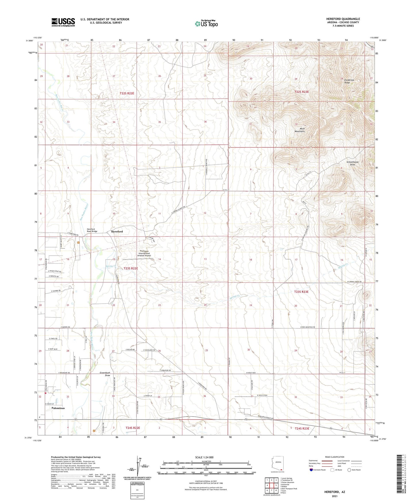
2021 topographic map quadrangle Hereford in the state of Arizona. Scale: 1:24000. Based on the newly updated USGS 7.5' US Topo map series, this map is in the following counties: Cochise. The map contains contour data, water features, and other items you are used to seeing on USGS maps, but also has updated roads and other features. This is the next generation of topographic maps. Printed on high-quality waterproof paper with UV fade-resistant inks.
Quads adjacent to this one:
West: Nicksville
Northwest: Lewis Springs
North: Tombstone SE
Northeast: Potter Mountain
East: Bisbee
Southeast: Naco
South: Stark
Southwest: Bob Thompson Peak
This map covers the same area as the classic USGS quad with code o31110d1.
Contains the following named places: Banning Creek, Bisbee Division, Cline Ranch, Coughran Ranch, Dinwiddie Ranch, Double Mill Ranch, Foudy Ranch, Fox Ranch, Greenbush Draw, Hereford, Hereford Dairy Ranch, Hereford Road Bridge, Lehner Mammoth-Kill Site, Palominas, Palominas Census Designated Place, Palominas Elementary School, Palominas Fire District Station 191, Palominas Post Office, Rancho del Rio, Rim Rock Ranch, San Pedro, San Rafael del Valle, Schoolhouse Draw, Spring Creek, Stagg Ranch, Stark Overpass, Thompson International Aviation Airport, Ullrich Ranch, Wiek Ranch