MyTopo
Stark Arizona US Topo Map
Couldn't load pickup availability
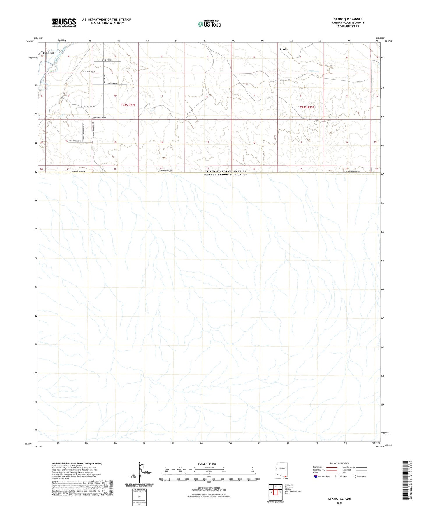
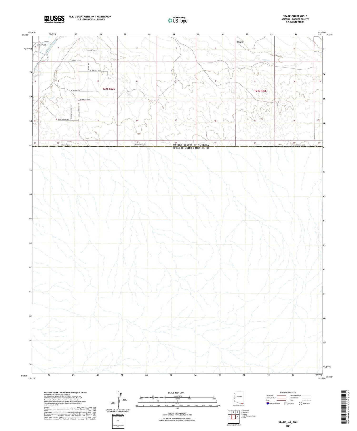
2021 topographic map quadrangle Stark in the state of Arizona. Scale: 1:24000. Based on the newly updated USGS 7.5' US Topo map series, this map is in the following counties: Cochise. The map contains contour data, water features, and other items you are used to seeing on USGS maps, but also has updated roads and other features. This is the next generation of topographic maps. Printed on high-quality waterproof paper with UV fade-resistant inks.
Quads adjacent to this one:
West: Bob Thompson Peak
Northwest: Nicksville
North: Hereford
Northeast: Bisbee
East: Naco
This map covers the same area as the classic USGS quad with code o31110c1.
Contains the following named places: S-O Ranch, Stark, Stark Railroad Station, Stark Well, Valley View Ranch