
MyTopo
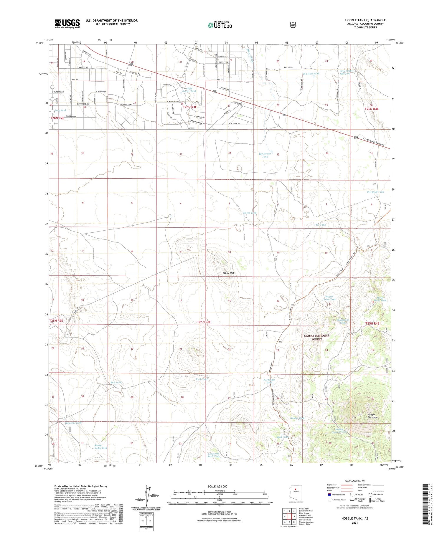
Hobble Tank Arizona US Topo Map
Couldn't load pickup availability
Also explore the Hobble Tank Forest Service Topo of this same quad for updated USFS data
2021 topographic map quadrangle Hobble Tank in the state of Arizona. Scale: 1:24000. Based on the newly updated USGS 7.5' US Topo map series, this map is in the following counties: Coconino. The map contains contour data, water features, and other items you are used to seeing on USGS maps, but also has updated roads and other features. This is the next generation of topographic maps. Printed on high-quality waterproof paper with UV fade-resistant inks.
Quads adjacent to this one:
West: Howard Lake
Northwest: Valle Tank
North: Molly Ann Draw
Northeast: Dog Knobs
East: Ebert Mountain
Southeast: Moritz Ridge
South: Squaw Mountain
Southwest: Howard Mesa
This map covers the same area as the classic USGS quad with code o35112e1.
Contains the following named places: Big Hocter Tank, Big Hole Tank, Buck Tank, Bull Tank, Chalender Ranger District, Chapparal Tank, Daves Tank, Fix Tank, Hardy Winter Camp, Hawkins Tank, Hobble Mountains, Hobble Natural Tank, Hobble Tank, Little Hocter Tank, Little Wild Bill Tank, Lonesome Knob Tank, Miller Wash Tank, NE Tank, Northeast Tank, Red Rock Tank, Rock Tank, Troy Tank, White Hill, Winter Camp Tank


