MyTopo
Moritz Ridge Arizona US Topo Map
Couldn't load pickup availability
Also explore the Moritz Ridge Forest Service Topo of this same quad for updated USFS data
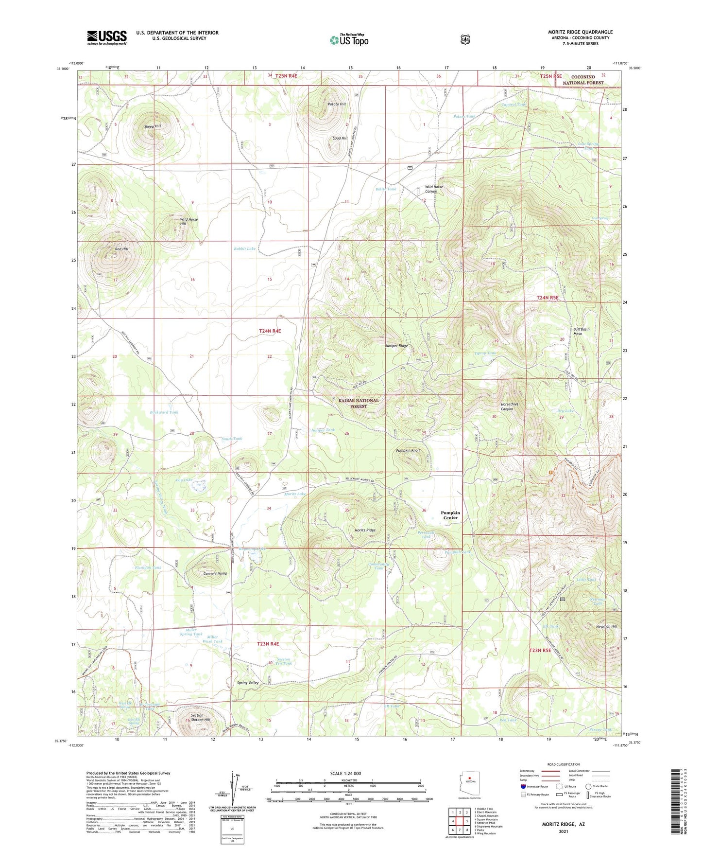
2021 topographic map quadrangle Moritz Ridge in the state of Arizona. Scale: 1:24000. Based on the newly updated USGS 7.5' US Topo map series, this map is in the following counties: Coconino. The map contains contour data, water features, and other items you are used to seeing on USGS maps, but also has updated roads and other features. This is the next generation of topographic maps. Printed on high-quality waterproof paper with UV fade-resistant inks.
Quads adjacent to this one:
West: Squaw Mountain
Northwest: Hobble Tank
North: Ebert Mountain
Northeast: Chapel Mountain
East: Kendrick Peak
Southeast: Wing Mountain
South: Parks
Southwest: Sitgreaves Mountain
This map covers the same area as the classic USGS quad with code o35111d8.
Contains the following named places: Backward Tank, BR Tank, Bull Basin Mesa, Cable Guzzler, Caporal Tank, Community Tank, Conners Hump, Drip Tank, Dry Lake, East Elk Spring, Elk Tank, Fay Lake, Flanigan Tank, Horse Tank, Horsethief Canyon, Juniper Ridge, Juniper Tank, Little Tank, Lost Spring, Lost Spring Tank, Lost Spring Water Tank, Marlar Tank, Miller Spring Tank, Miller Wash Tank, Moritz Lake, Moritz Ridge, Newman Hill, Newman Tank, Perreault Tank, Potato Hill, Potato Tank, Pumpkin Center, Pumpkin Knoll, Pumpkin Tank, Rabbit Lake, Raymond Lake, Red Hill, Red Tank, Section Sixteen Hill, Section Ten Tank, Serape Tank, Sheep Hill, Smith Tank, Spring Valley, Spud Hill, Spud Tank, Tiptop Tank, Turkey Tank, West Elk Spring, White Tank, Wild Horse Canyon, Wild Horse Hill, Wildlife Guzzler, W-Triangle Tank