MyTopo
Valle Tank Arizona US Topo Map
Couldn't load pickup availability
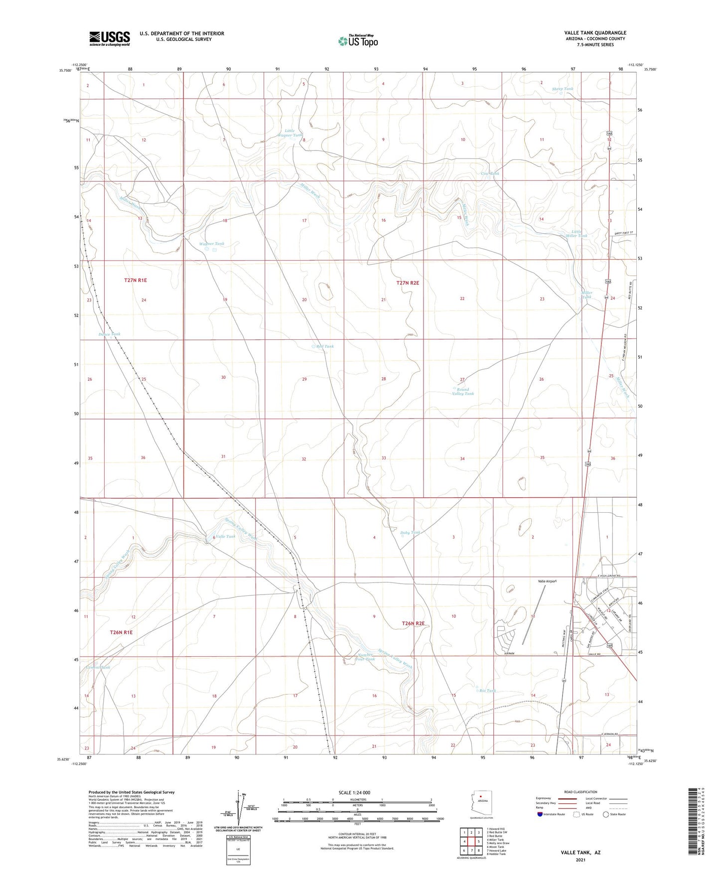
2021 topographic map quadrangle Valle Tank in the state of Arizona. Scale: 1:24000. Based on the newly updated USGS 7.5' US Topo map series, this map is in the following counties: Coconino. The map contains contour data, water features, and other items you are used to seeing on USGS maps, but also has updated roads and other features. This is the next generation of topographic maps. Printed on high-quality waterproof paper with UV fade-resistant inks.
Quads adjacent to this one:
West: Miller Tank
Northwest: Howard Hill
North: Red Butte SW
Northeast: Red Butte
East: Molly Ann Draw
Southeast: Hobble Tank
South: Howard Lake
Southwest: Mixon Tank
This map covers the same area as the classic USGS quad with code o35112f2.
Contains the following named places: Bedrock City Recreation Site, Cement Tank, Cow Tank, Dance Tank, Doby Tank, Little Miller Tank, Little Wagner Tank, Miller Tank, Number Four Tank, Red Tank, Rio Tank, Round Valley Tank, Sheep Tank, Valle, Valle Airport, Valle Census Designated Place, Valle Railroad Station, Valle Siding, Valle Tank, Wagner Tank