MyTopo
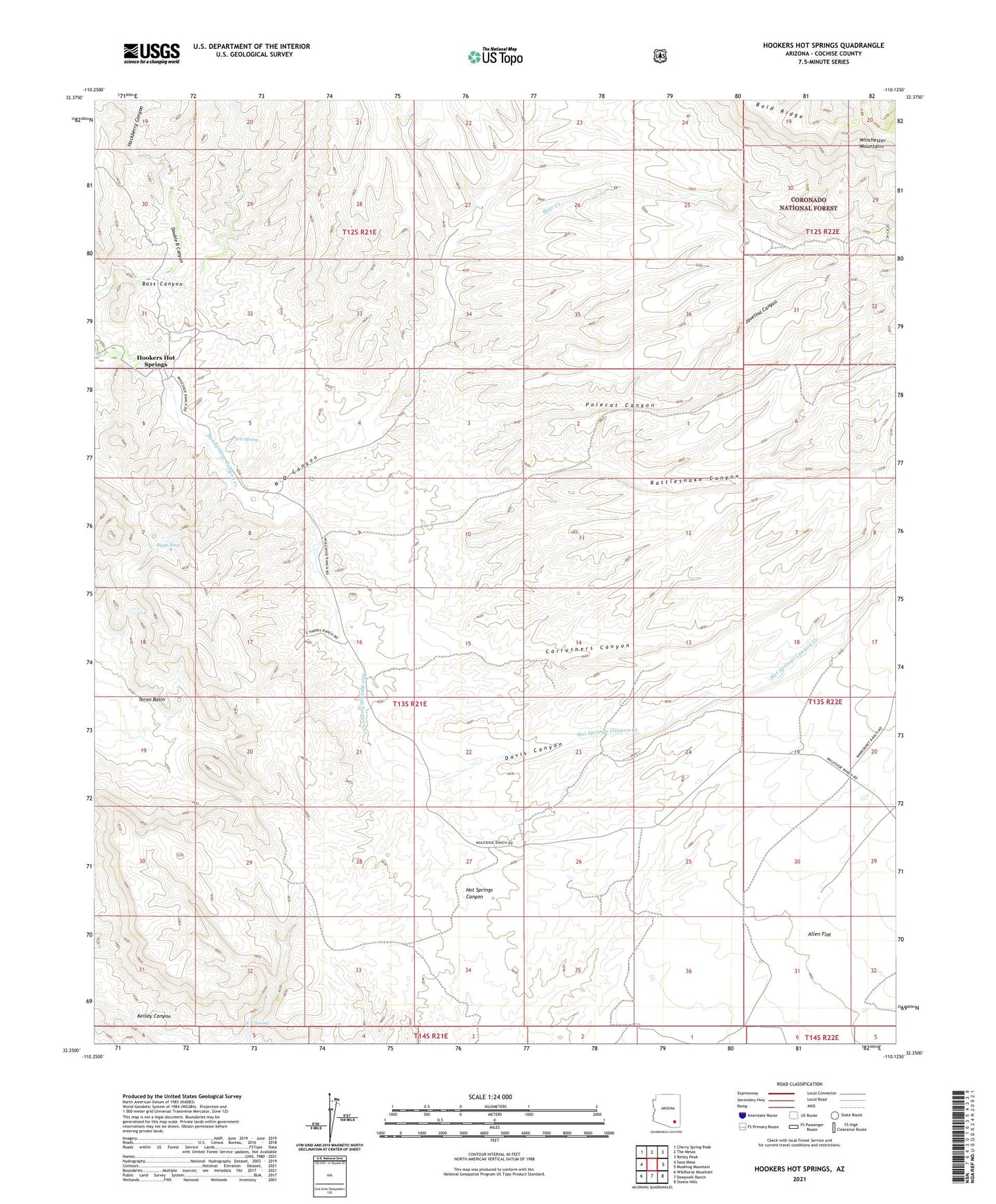
Hookers Hot Springs Arizona US Topo Map
Couldn't load pickup availability
Also explore the Hookers Hot Springs Forest Service Topo of this same quad for updated USFS data
2021 topographic map quadrangle Hookers Hot Springs in the state of Arizona. Scale: 1:24000. Based on the newly updated USGS 7.5' US Topo map series, this map is in the following counties: Cochise. The map contains contour data, water features, and other items you are used to seeing on USGS maps, but also has updated roads and other features. This is the next generation of topographic maps. Printed on high-quality waterproof paper with UV fade-resistant inks.
Quads adjacent to this one:
West: Soza Mesa
Northwest: Cherry Spring Peak
North: The Mesas
Northeast: Reiley Peak
East: Muskhog Mountain
Southeast: Steele Hills
South: Deepwell Ranch
Southwest: Wildhorse Mountain
This map covers the same area as the classic USGS quad with code o32110c2.
Contains the following named places: Antelope Ranch, Bald Ridge Number Two Tank, Bear Creek, Bear Tank, Carruthers Canyon, Cement Dam Tank, Davis Canyon, Double R Canyon, Hackberry Canyon, Hookers Hot Springs, Javelina Canyon, Muleshoe Ranch, N-O Canyon, N-O Spring, Polecat Canyon, Rattlesnake Canyon, Riggs Seep, V-F Spring